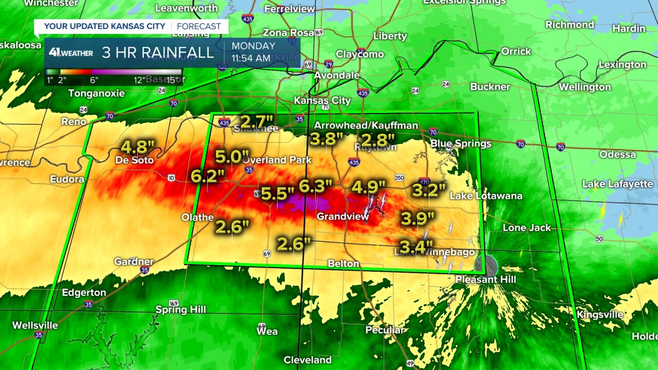
KANSAS CITY, Mo. — Bands of heavy rain moved through the Kansas City area late Monday morning and early Monday afternoon, dropping more than six inches of rainfall in spots.
—
UPDATE, 3:45 p.m. | The National Weather Service replaced the flash flood warning with a flood warning.
UPDATE, 3:12 p.m. | All Johnson County, Kansas, Parks and Recreation trails that are paved along creeks are closed due to flooding and debris. Cleanup efforts are underway.
The affected areas include Coffee Creek Streamway Park, Cedar Niles Park, Kill Creek Streamway Park and Mill Creek Streamway Park.
JCPRD said closures are expected through at least Wednesday, July 3.
UPDATE, 1:55 p.m. | Sewers in the Kansas City area are working overtime as flooding concerns remain throughout the afternoon.
Can confirm 5+ near JCCC
— Matt Gasper (@MattGasperTV) July 1, 2024
(Bags & branches were eventually swept toward the sewer during the monsoon!) #kswx https://t.co/JR0fSaMMj4 pic.twitter.com/WvPuEpHbFv
UPDATE, 1:28 p.m. | Lamar Avenue at Indian Creek Drive is one of many flooded spots in Overland Park.
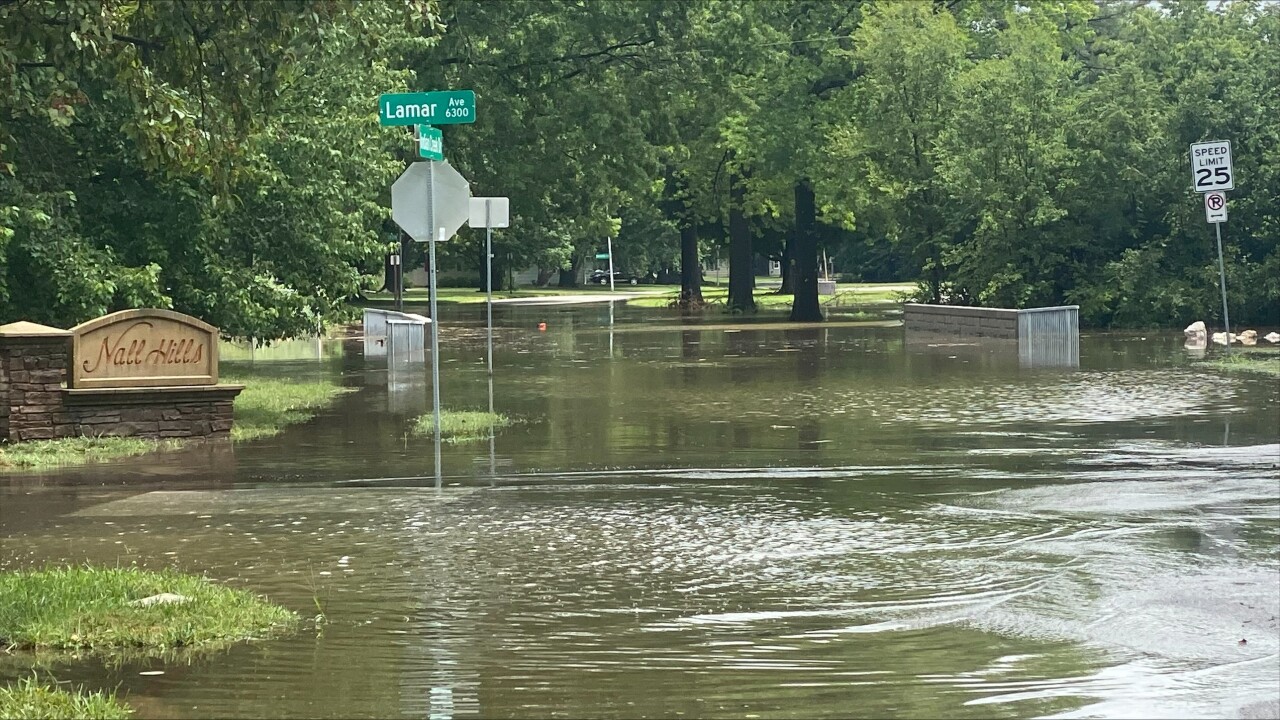
Emergency management crews are urging the public to "turn around, don't drown." Do not drive through areas of high water.
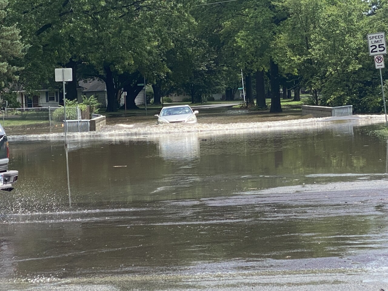
The Overland Park Police Department continues to post updates on street closures on social media.
UPDATE, 12:42 p.m. | Leawood police say several roadways across the city are closed due to rising water: 8700 block of Lee Boulevard; 119th Street at Tomahawk Creek and Tomahawk Creek Parkway.
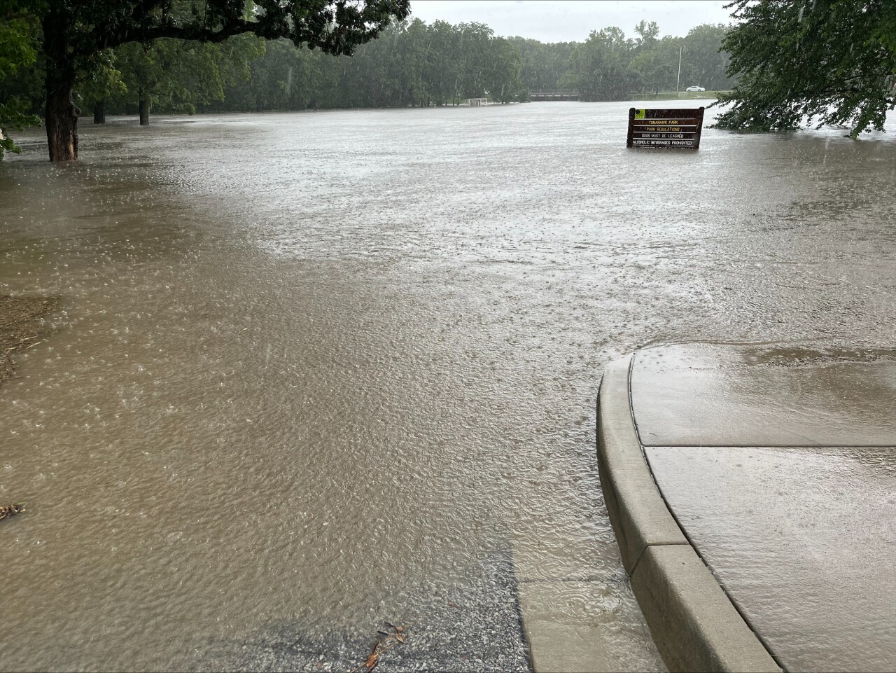
UPDATE, 12: 30 p.m | Overland Park police have closed a section of a frontage road along Interstate 35 due to water on the roadway.

UPDATE, 12:20 p.m. | KSHB 41 viewer Steve Beebe is checking in from the No. 6 fairway at Falcon Valley Golf Course in Lenexa. Looks like golf might be hard to play today.
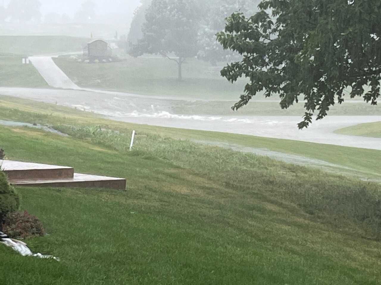
It's also slow going near Mission Hills Golf Club.
Prairie Village police report high water along Brush Creek on Mission Drive.
Today is a good reminder of how quickly the water can rise, especially along Brush Creek on Mission Drive in Mission Hills! Stay safe and turn around if you need to! pic.twitter.com/octUkk20V4
— Prairie Village Police (@PVPoliceDept) July 1, 2024
UPDATE, 12:15 p.m. | KSHB 41 Weather's Lindsey Anderson says several locations in the southern half of the area have now received in excess of five inches of rain over the last several hours.
UPDATE, 12:10 p.m. | Overland Park fire fighters say crews have rescued a number of people from flooded vehicles after flash flooding in the area of 124th Street and Nall Avenue.
Crews rescued a number of people from flooded vehicles during flash flooding at 124th and Nall. No injuries reported. Water quickly receding. pic.twitter.com/C0meRmEvCJ
— Overland Park Fire (@OverlandParkFD) July 1, 2024
UPDATE, 12 p.m. | Power has been restored at the Johnson County, Kansas, government offices at 6000 Lamar.
In Overland Park, police said all lanes are closed eastbound on W. 199th from Grant Street to Three Lakes Parkway due to flooding. Drivers are asked to avoid the area.
UPDATE, 11:45 a.m. | Police in Blue Springs report parts of Interstate 70 have ponding water. Side roads are also dealing with areas of water.
Johnson County, Kansas, Emergency Management reports several water rescue and water assist calls have been made within the last 30 minutes across the county.
KSHB 41's Lindsey Anderson reports parts of Lenexa have received more than five inches of rain in the last three hours. An area along the south side of Interstate 435 from Lenexa east to southern Kansas City has also received in excess of three inches of rain in the last three hours.
UPDATE, 11:40 a.m. | It's not clear if it's weather-related, but the Johnson County government offices at 6000 Lamar are closed due to a power outage.
A power outage at our Northeast Offices (6000 Lamar Ave., Mission) is currently impacting services, including Motor Vehicles.
— Johnson County, Kan. (@jocogov) July 1, 2024
We will post more information as it becomes available. pic.twitter.com/QYp6z9ZYiR
UPDATE, 11:35 a.m. | The National Weather Service just activated cell phone notifications for some residents as rain continues to fall across the area.

UPDATE, 11:30 a.m. | We're hearing some reports on the scanner of high water along Indian Creek in Overland Park and south Kansas City. So far, no injuries reported.
The rain continues to fall in southern Overland Park.
This is how flash flooding begins as significant runoff increases from many locations. It took 15 minutes to get to this point in south OP. @KSHB41 pic.twitter.com/NotSwJqmG0
— Jeff Penner (@JeffPennerKSHB) July 1, 2024
UPDATE, 11:15 a.m. | KSHB 41 meteorologist Jeff Penner just checked in from a water-logged southern Overland Park:
Torrential rain moving through south OP. 2”-3” rain rate per hour. This is the reason for the Flash Flood Warning. The thunderstorms, very heavy at times will end around 1 PM. “Turn Around Don’t Drown.” @KSHB41 pic.twitter.com/PiN0SVZWgs
— Jeff Penner (@JeffPennerKSHB) July 1, 2024
UPDATE, 11:10 a.m. | Douglas County emergency management officials spotted a tree that lost its footing due to the soggy conditions Monday morning:
The heavy rain Monday morning made the ground soft enough for this Bur oak tree, 100-plus years old, with a preexisting disease to come out of the ground. Lt. Mehrer took the photo of Richard Rawlings with the tree at the Lone Star turnoff near E 800 and E 661 Diagonal roads. pic.twitter.com/XHJF9Q76Cb
— Douglas Co. Sheriff (@DGSOSheriff) July 1, 2024
UPDATE, 11 a.m. | Police in Lenexa report several areas of high water have formed from this morning's rain:
We are seeing numerous locations around Lenexa that have high water across the roadway. When in doubt, DO NOT attempt to drive across flooded roadways as you may become stuck. #TurnAroundDontDrown
— Lenexa Police (@LenexaPolice) July 1, 2024
10:45am: A Flash Flood Warning has been issued for metro areas south of the Missouri River! Areas in the warning have already received nearly 1-3.5" of rain in less than 3 hours. Watch for flooded roads, especially in poor drainage spots!@kshb41 pic.twitter.com/trHvX6Bus1
— Lindsey Anderson (@lnanderson) July 1, 2024
The National Weather Service has included Johnson County, Wyandotte County, south-central Leavenworth County and northern Miami County in Kansas.
Flash Flood Warning including Kansas City MO, Overland Park KS and Kansas City KS until 1:45 PM CDT pic.twitter.com/ulW8gyBHtp
— NWS Kansas City (@NWSKansasCity) July 1, 2024
Missouri's Jackson County and northern Cass County are included, too.
Some areas have received up to 3.5 inches of rain already with an additional 0.5-1.5 inches possible, per NWS.
Residents are asked to remain aware of flooding near creeks and streams as well as highways, streets and other low-lying areas.
Further west, some low-lying areas in Douglas County, Kansas, have prompted a flash flood warning.
Flood Warning until 1PM (7/1).
— Douglas Co. EM (@dgcoem) July 1, 2024
IMPACTS: Flooding of rivers, creeks, streams, & other low-lying/flood-prone locations is imminent or occurring. Streams cont. to rise due to excess runoff from earlier rainfall. Our office from around 10:14AM. Don't drive over flooded roads! pic.twitter.com/gBvMmoy7ok
—


