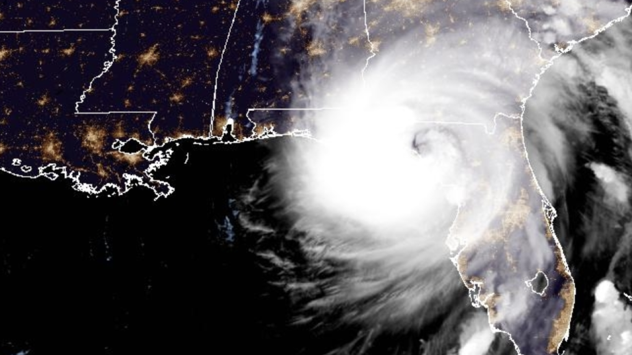
FOR THE LATEST UPDATES, CLICK HERE: Helene downgraded to tropical storm after making landfall as Category 4 hurricane
Hurricane Helene officially made landfall in Florida's Big Bend at 11:10 p.m. EDT, about 10 miles west of Perry, the National Hurricane Center confirmed. The Category 4 storm was producing maximum sustained winds of 140 mph, according to the agency, which was basing its assessment on data from Air Force reconnaissance aircraft.
Perry is located about 50 miles southeast of Tallahassee.
People along Florida's Big Bend were warned about catastrophic and deadly storm surge, which could reach 20 feet above ground.
"There is also a danger of life-threatening storm surge along the remainder of the west coast of the Florida Peninsula," the National Hurricane Center warned.
As of Thursday night, nearly 1 million people in Florida were without power.
The storm is forecast to slow down once it's no longer over water, but it is still expected to bring hurricane conditions inland.
RELATED STORY | United Cajun Navy prepares as Hurricane Helene rapidly advances on the Gulf Coast
The National Hurricane Center has stressed that residents of the Southeastern U.S. should not focus on just the point of landfall or the storm's exact track. While the worst impacts likely will be felt at the coast, flooding and tornadoes are expected hundreds of miles inland.
Catastrophic hurricane-force wind is expected over northern Florida and Southern Georgia. Tropical storm-force winds are expected as far north as North Carolina.
President Joe Biden on Thursday approved a pre-landfall disaster declaration for Alabama, Florida, Georgia and North Carolina. The step frees up more federal resources and communication for affected states as they respond to the storm.
Impacts to travel
Tampa International Airport suspended operations early Thursday morning ahead of the storm. Tallahassee International Airport has also suspended operations for Thursday. Both airports will reopen when it is safe to do so.
Many airlines at Southwest Florida International Airport, which serves the Fort Myers region, suspended operations on Thursday.
Sarasota Airport is open, but many flights have been canceled or delayed.
RELATED STORY | Medical professionals are changing their training due to climate change
What caused Helene to become so strong?
Helene spent time over relatively warm waters in the Gulf of Mexico, which provided more heat energy to the storm and increased its intensity.
There was also little wind shear to disrupt the storm's formation.
Editor's Note: A previous version of this story said Hurricane Helene made landfall around 10:05 p.m. ET. While the storm began moving ashore at that time, the National Weather Service defines landfall as "the intersection of the surface center of a tropical cyclone with a coastline."


