


Happy Super Bowl Sunday blog readers —
While the big day has arrived, we have a BIG weather week to talk about. So let's get right to it!
We have three storms and two different Arctic air pushes to prepare for as we navigate the middle of February.

We have a pocket of Arctic air to our north and gulf moisture trapped to our south. And both are getting ready to make their respective moves.
As these two ingredients come together, we are fueling multiple winter storms.

Storm 1 | LOW SNOW: Monday evening - Tuesday morning
By Monday afternoon, some flurries could be possible ahead of the cold front, but the main impact looks to come together overnight into Tuesday.


This will be a quick clip of light snow that could bring a dusting to 1 inches regionally with maybe a few spots getting closer to 2 inches.
Overall expect low snow out of this as it is just an appetizer. The bigger focus here is this front will unleash the Arctic blast!

Storm 2 | BIGGER SNOW: Tuesday night - all day Wednesday
Wednesday's snow event has more of our attention. The track of this storm has been fairly consistent and holding Kansas City in its cross hairs.
Right now, models are fairly consistent on bringing at least 3-6 inches across the area with this storm, but one model has a bigger bulls eye SW of Kansas City, while the other has one NE into Illinois.
It isn't out of the question that we could see a few locations receive more than 6 inches of snow with this storm.

So if the first storm is an appetizer, this storm is certainly our main course.
We are expecting the heaviest snow to hit all day Wednesday. Make sure to stay up to date as the snow map for Wednesday is still evolving! But honestly Wednesday looks to be the roughest day of the week.

Arctic blast #1 | Dangerous Cold — Monday night through Friday midday
The cold front that moves through Monday night's main super power is the Arctic air is will drag in.
Next week looks really cold with the worst of the cold hugging Wednesday into Thursday. Overnight lows will be in the single digits and wind chills during the day in the low teens.

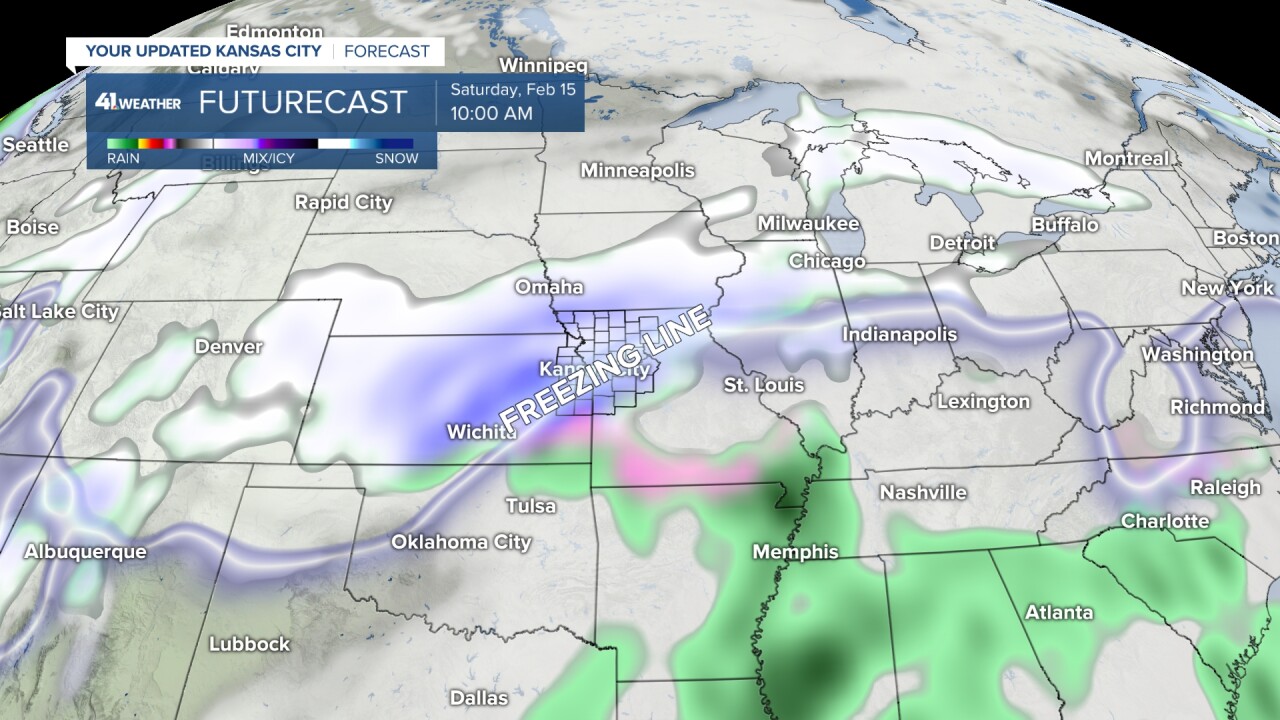
Storm 3 | Mixed Bag: Friday night into Saturday
The third system still is working itself out, so honestly there isn't much to say quite yet, except that this one could be messy.
We look to shake the Arctic Air Friday which means we will watch the freezing line retreat north a bit.
This places Kansas City into a zone where rain, ice and snow will all be possible. So this is your heads up that we are watching a storm that could create ice accumulations. And this one looks to have some healthy moisture as of now. Stay tuned for more on this!
Arctic blast #2 | Dangerous cold: Saturday night into early next week
Another push of VERY cold air is looking likely for Valentine's weekend.
So make those dates cold weather compatible and be prepared for the snow that falls during the week to stick around!

It's going to be a long week when it comes to pushing through the cold and the snow, so don't forget to be kind to each other Chiefs Kingdom!
—
