Good Monday bloggers —
We've got that "air you can wear" out there today and it's not going away anytime soon.
While summer is still a few days away, it already feels like it.
In Mexico, it has felt like summer since March.
Mexico has been dealing with a series of heat waves, and before I get too far into this and you think, 'What does Mexico have to do with Kansas City?,' our synoptic pattern is tapping into their heat.
Mexico is reporting 48 deaths, and 950 people have suffered heat related health impacts since March.
Mexican President Andres Manual Lopez Obrador credits climate change to be influencing this years exceptional heat.

So let's take a look at the climate influence.
The Climate Shift Index (CSI) is a tool developed by Climate Central that defines the ratio of how common a temperature is in today’s altered climate vs. how common it would be in a climate without human-caused climate change.
It is a global tool and rates this current Mexican heatwave at a CSI of 5.
This means that climate change has an exceptional footprint on this heat wave, making these conditions five times more likely.

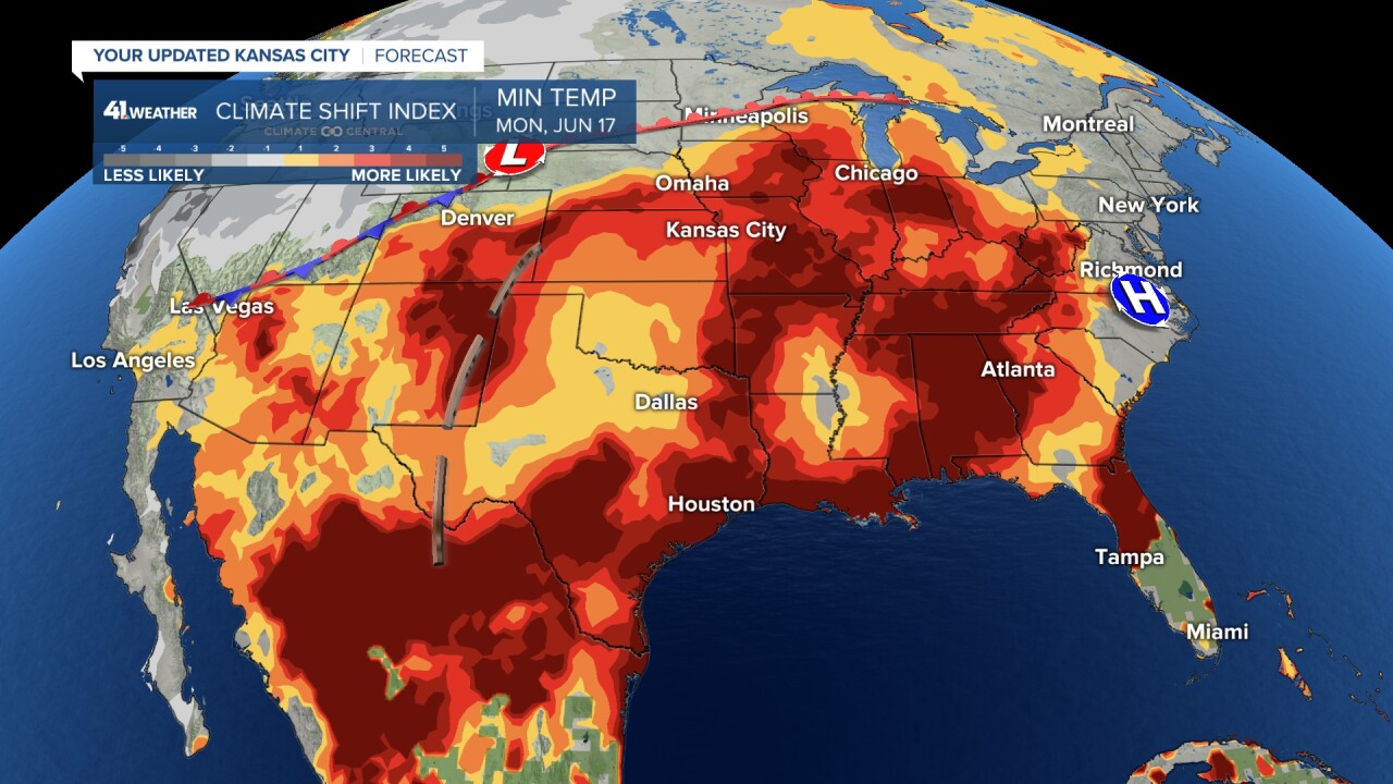
Our weather pattern has created a "heat highway" from Mexico into the Great Plains and across to the east coast.
We are seeing this set up due to a heat dome that is building to our southeast coupled with a mid-latitude cyclone pulsing through the Rockies.
The warm branch of this low is basically riding the edge of the heat dome and pulling heat from Mexico north and northeast.

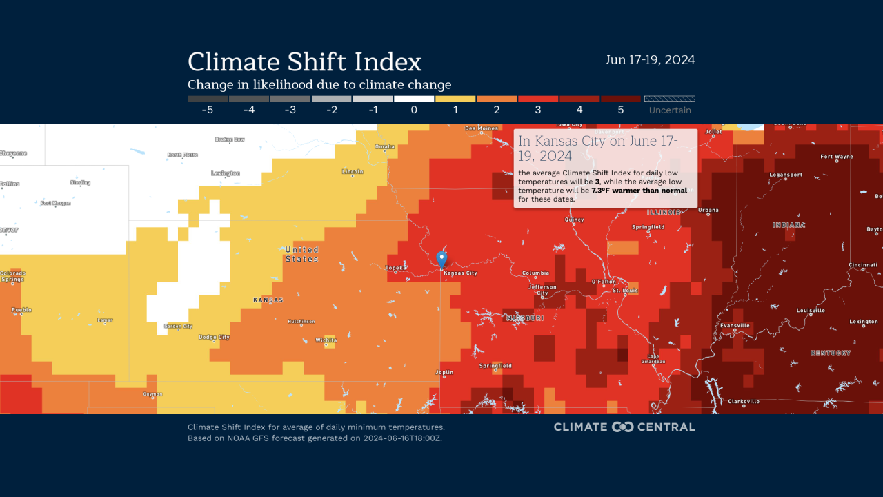
But it's not necessarily our daytime temperatures in Kansas City that are getting a boost due to climate change, it is our overnight temperatures.
We should be seeing temperatures in the mid 60s during our overnight recovery period, but that is just not the case.
We are holding in the mid 70s for the next 48 hours.
The average CSI for the next three days in Kansas city is a three, meaning climate change has it's finger print on our sleeping weather.


According to Climate Central, summer minimum (nighttime) temperatures across the U.S. have warmed on average at a rate of 1.64°F per century since records began in 1895.
That’s nearly twice as fast as the warming rate observed for average U.S. summer daytime highs over the same period.
Warmer overnights are a concern because it can prolong heat stress and related health risks, but also increase energy consumption which means bigger bills.
So with our current weather pattern is funneling in heat from Mexico, shouldn't it be a "dry heat?"
Well, unfortunately, we're dealing with a double whammy.
The way the heat dome is building over the southeast has kept the Gulf of Mexico open, pumping tropical moisture into Kansas City and beyond.

But there is some good news with our current weather pattern — that low in the Rockies, well it will eventually get moving.
That will sweep the climate fueled heat away from us by Wednesday.
We will see Canadian high pressure wrap in some cooler air behind this front, but it may not get all the way to Kansas City and may be short lived.

We are expecting the heat dome to nudge it's way back to us with 90s or near 90 holding as we begin to close out June.
This comes as the Climate Prediction Center has forecast summer 2024 to be one of the hottest on record for the lower 48.
—


