


KANSAS CITY, Mo. — Happy Friday, everyone! What a difference a day makes! A cold front moved through last night, bringing our wettest day in Kansas City since June 26.
We officially picked up 1.27" of rain at KCI, with most of the heavy rainfall staying on the north side of town. Jackson County, Missouri, and Johnson County, Kansas, saw less than 0.25".
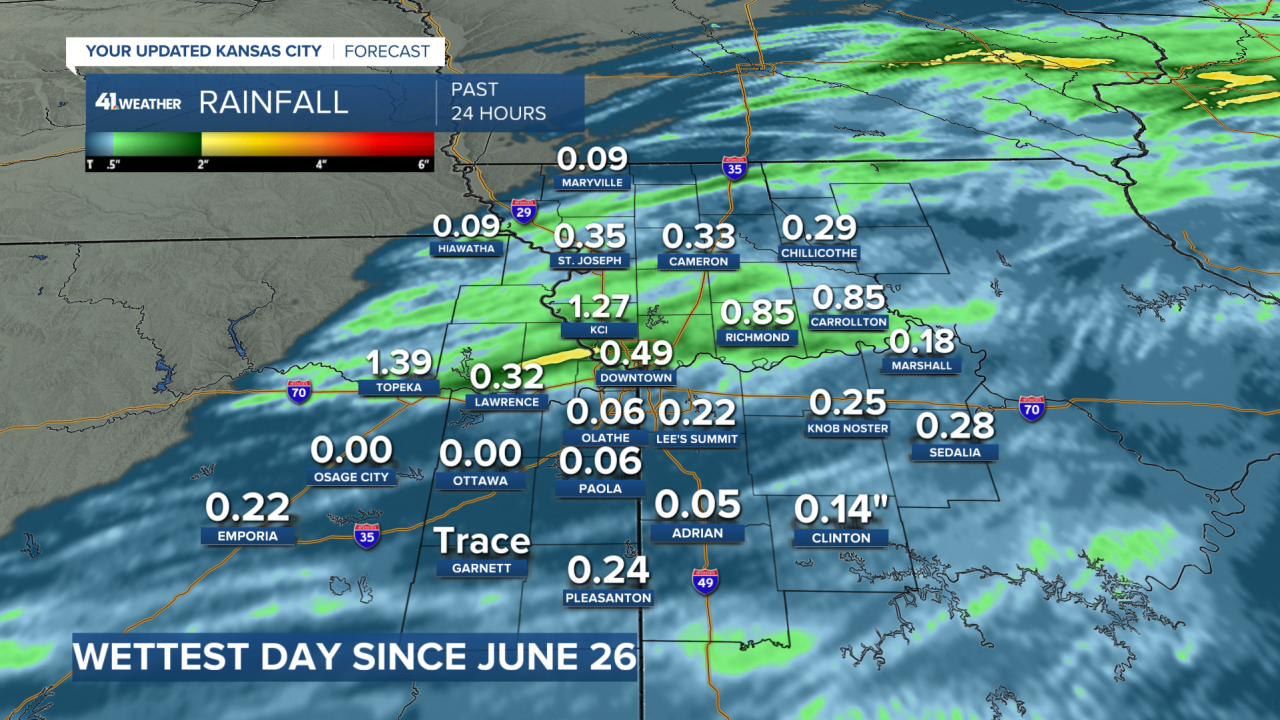
The north side of town also bore the brunt of the storms, leading to downed power lines and trees.

If you didn't get much rainfall last night, there are strong indications of more heavy rainfall and, unfortunately, severe weather next Wednesday night.
Temperatures will feel much more like fall this weekend, and it will look the part too. The Missouri Department of Conservation says the Kansas City region is near peak fall foliage, while northwestern MO and northeastern KS are at peak.
You can check out the MDC website for more information about scenic drives. Ward Parkway is looking quite beautiful right now.
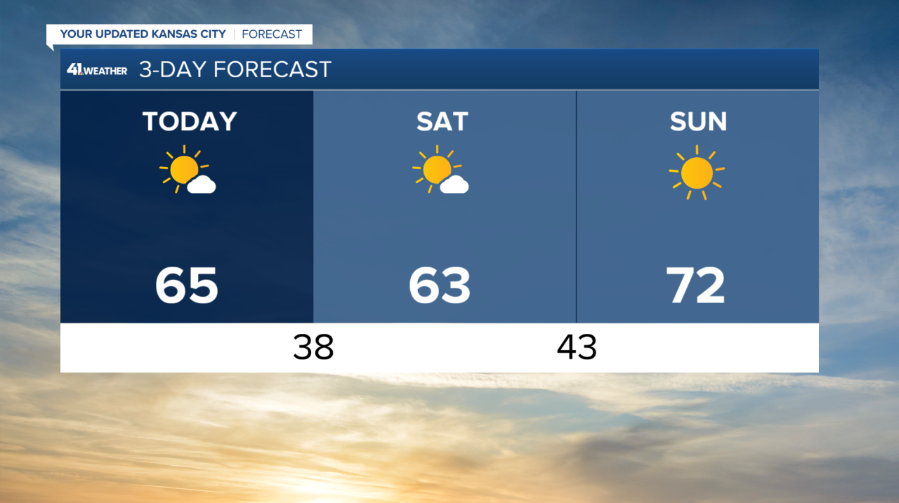
Highs on Friday and Saturday will be in the lower to mid-60s, with a chilly northerly breeze on Friday.
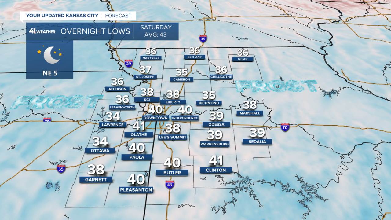
Some frost is possible Saturday morning as temperatures dip into the mid-30s in parts of Kansas and Missouri.
Sunday looks to be the best day of the weekend, with morning temperatures in the 40s, afternoon highs in the lower 70s under sunny skies, and a light southerly wind.
Speaking of wind, it looks significantly windy on Monday and Tuesday. There may be wind gusts of 50 mph or greater on both days! So, those of you with large inflatable Halloween decorations should consider anchoring them down better or not inflating them at all.
The strong southerly winds will push temperatures into the 80s on those two days, followed by storms, possibly severe, on Wednesday evening or night.
—
