


Happy Tuesday, blog readers —
Kansas City's weather is always a rollercoaster ride. This week, wildfire smoke and Hurricane Francine will keep us on our toes.
Like a game of dodgeball, we are looking to dodge the big hits from both threats!
While we are seeing some haze out there today, it's not from the fires burning thousands of acres out west. It's from smaller fires in northern Mississippi, Alabama and some prescribed burns along the Mississippi River.

The weather pattern out west is a blocked ridge of high pressure, keeping the area hot and dry with stagnant air.
There is also a cold front through Montana collecting smoke and creating localized dense smoke impacts through the northern Great Plains.
In Kansas City, our airflow is coming around a high-pressure system in Virginia, gently picking up a little bit of smoke along the way.
Here is a look from one of our skycams looking southeast. You can certainly see some haze out there.

The smoke layer is mostly staying aloft, minimizing its impact on our air quality.
As a bonus, we could see some stunning sunrises and sunsets due to the smoke particles scattering sunlight.
This phenomenon is known as Mie scattering, which occurs when particles are larger than the wavelengths of visible light.
Rayleigh scattering, which causes the blue color of the sky, is less likely to occur with larger particles like smoke.
Right now, we are in the clear from a big push of wildfire smoke. The cold front that is pooling smoke will not impact Kansas City, mainly thanks to Francine!
Tropical Storm Francine is currently showing signs of strengthening. I expect Francine to reach Category 1 status sometime today.
The latest update is that the storm's track has shifted eastward, potentially impacting Mississippi and Alabama, in addition to Louisiana, with 5-10 feet of storm surge, damaging hurricane-force winds, heavy rainfall and the risk of significant flooding.
Right now, it is expected to be a Category 1 hurricane at landfall. It will then undergo rapid weakening as it moves up the Mississippi River.

The location of Hurricane Francine's landfall will significantly impact whether Kansas City receives any tropical moisture.
Currently, the storm is on the edge of the southern Great Plains.
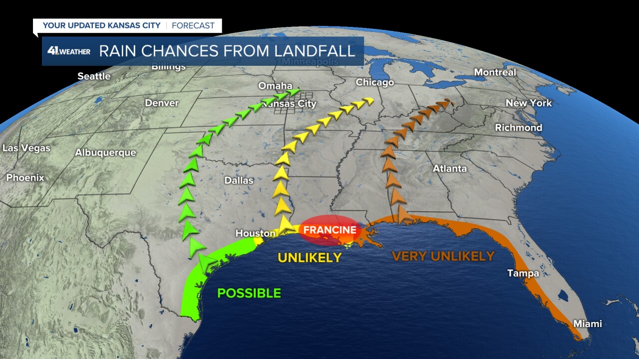
We'll definitely see more clouds as Hurricane Francine approaches. Look for the clouds to thicken up by Thursday morning.
As you watch the clouds roll in, know it's just a friendly hello from Francine.

While we're unlikely to see much direct rain, we could experience some outer rain bands from Hurricane Francine moving in from the east on Friday morning.
These bands are more likely to impact areas like Warrensburg and Sedalia.

While Kansas City dodged the smoke and rain this time, it's not necessarily a win-win. We need some solid rain!
August was a very dry month for Kansas City. Only 1.60" of rain made our 30-day rain deficit map light up.

While there's a hint of increased moisture for the northern Great Plains next week, Kansas City doesn't seem to be in the direct path of any major storms.
Additionally, the Climate Prediction Center's fall outlook suggests a drier-than-normal season for our area.

—
