


Happy Friday, weather blog readers!
Get ready for a summer scorcher this weekend! We're expecting a warm-up with plenty of sunshine, but keep an eye out for a chance of afternoon thunderstorms, especially later on Saturday.
Friday:
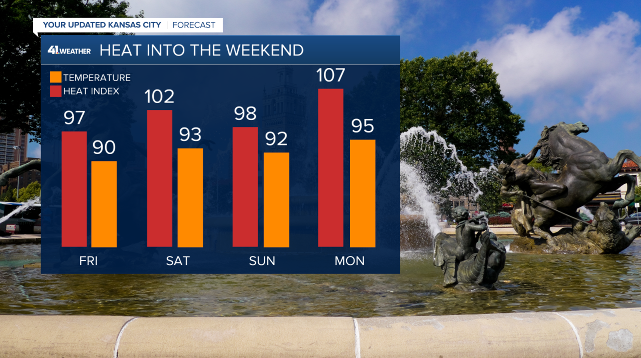
For the rest of Friday, isolated showers and storms may bubble up in the afternoon heat and humidity as moisture continues to stream north from the Gulf. Even if the clouds don't produce showers, they'll at least provide some shade as heat indices near 95-99 across the metro.
Don't forget about the full Strawberry Moon this evening!
Saturday:
Saturday will be a scorcher! Expect the heat to crank up with highs reaching the lower to mid-90s. While it'll be mostly sunny in the morning, clouds will build in the afternoon, bringing with them a chance of thunderstorms.
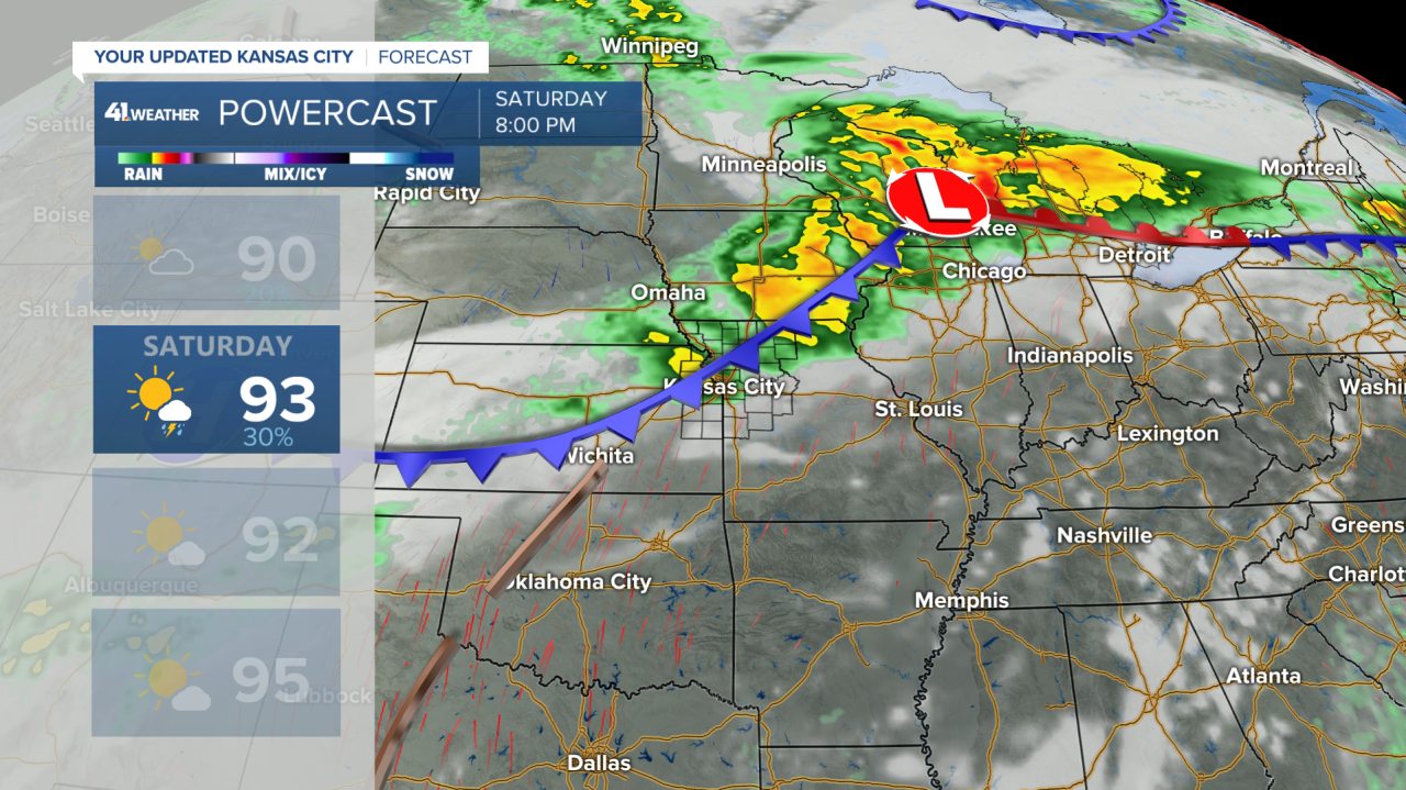
Isolated storms are possible in the afternoon ahead of a cold front moving through in the evening. The timing for the best chance of storms is between 7-11 p.m. I wouldn't say everyone in the metro will get thunderstorms, but it's our best shot until Tuesday night.
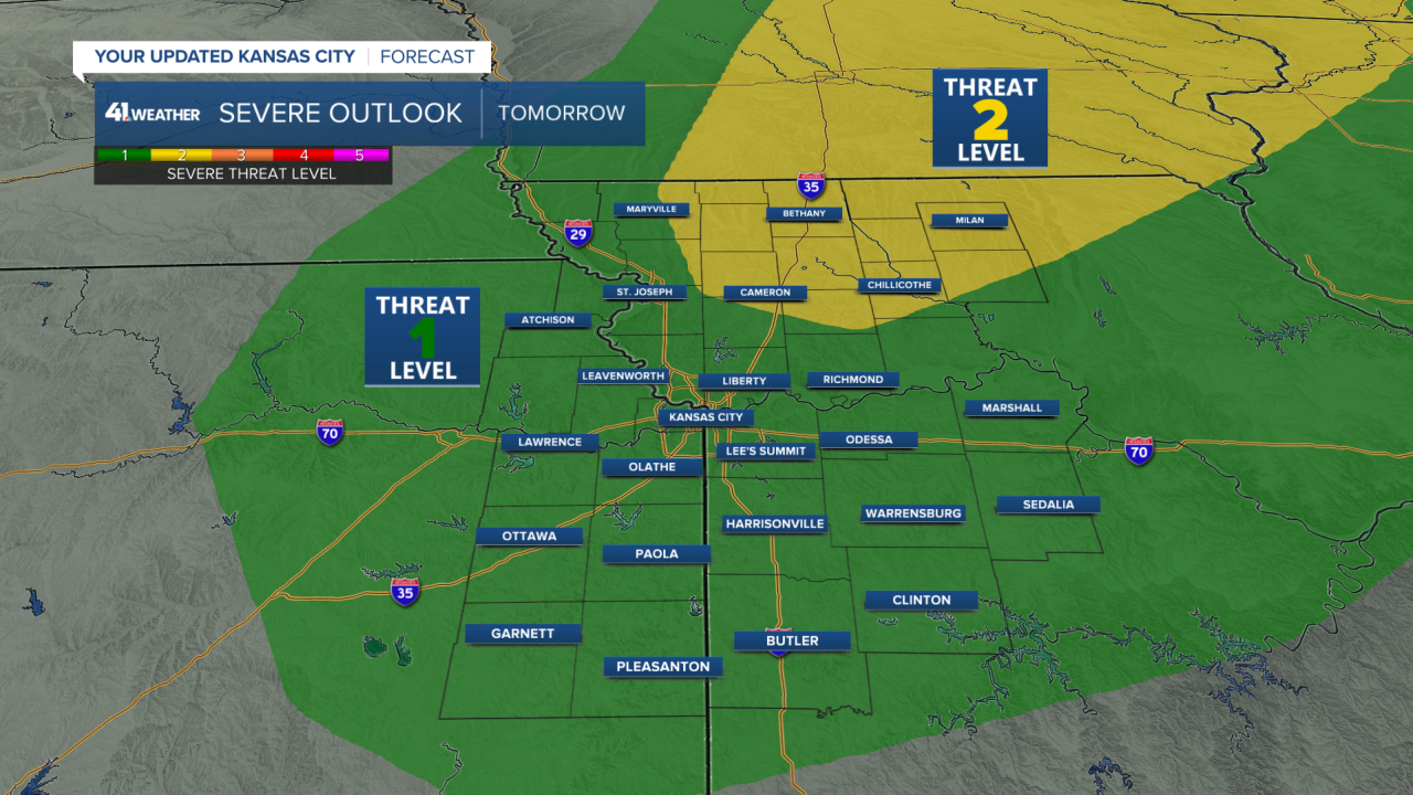
There's a level 2 (out of 5) threat for severe storms in north-central Missouri, where storms are more likely. Meanwhile, Kansas City is under a level 1 (out of 5) threat. No matter your threat level, damaging wind gusts and hail are the potential severe hazards.
The rainfall will likely end overnight as the cold front moves through. Technically, this is a cold front, and temperatures may cool slightly along with the heat index, but there won't be a big difference in the overall feel from Saturday into Sunday.
The heat index on Saturday will be in the lower 100s, while Sunday will be in the upper 90s. Still, that's better than Monday, when the heat index may reach 105-100!
Stay cool this weekend, everyone!
