


KANSAS CITY, Mo. — The National Oceanic and Atmospheric Administration released its winter outlook this week, which favors above average temperatures across the northern half of the United States and above average precipitation in the southern half.
As usual, Kansas City is stuck in the middle of both.
The outlook's release comes as a powerful El Niño continues to build.
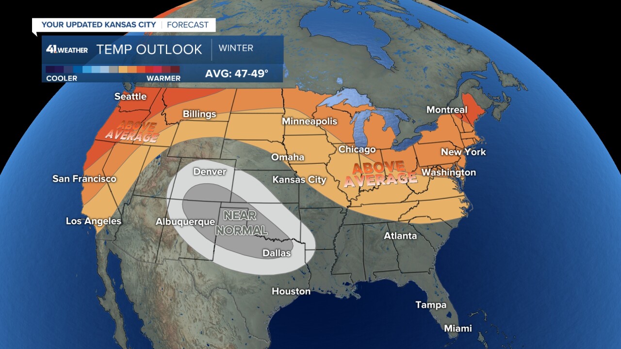
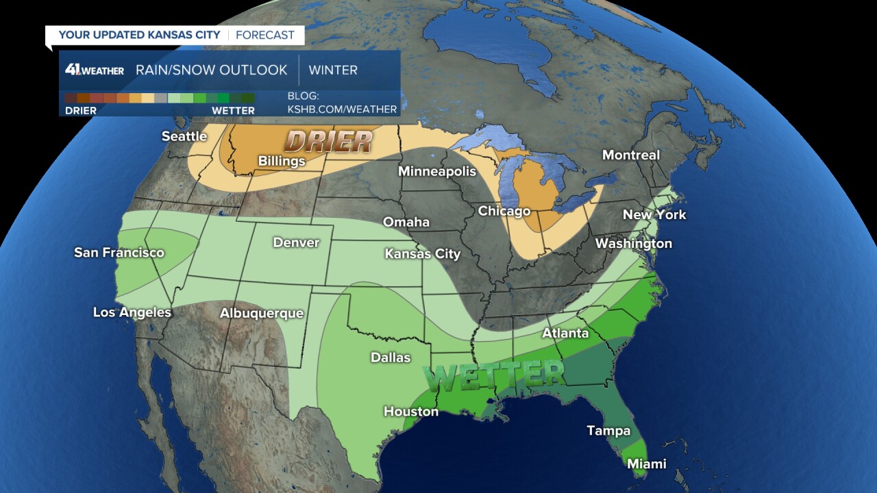
For the KSHB 41 viewing area around Kansas City, portions of Missouri are in the above average shading for temperatures, with the Kansas side remaining in the equal chance zone. In past years of a strong El Niño, the Kansas City area leaned well above average in temperature. On the precipitation front, we are forecast to trend wetter than normal, but that doesn't necessarily mean more snow. Previous El Niño's in Kansas City lean strongly wetter than normal for rainfall by an inch or two. It's hard to pinpoint any significant trend as it relates to snow.
Strongest El Ninos & Kansas City Snow
- 2015-2016: 5.3''
- 1997-1998: 12.5''
- 1982-1983: 14.4
- 1972-1973: 14.3''
- 1957-1958: 22.9''
- 1991-1992: 2.2''
Here's a quick breakdown for other parts of the country:
Temperature
- Warmer-than-average temperatures are favored across the northern tier of the U.S. and much of the Far West.
- The greatest odds for warmer-than-average conditions are in Alaska, the Pacific Northwest and northern New England.
- Near-normal seasonal mean temperatures are most likely for a region from the south-central Rockies to the southern Plains.
- Remaining areas fall into the category of equal chances for below-, near-, or above-average seasonal mean temperatures.
Precipitation
- Wetter-than-average conditions are most likely in northern Alaska, some areas of the West from parts of California to the south-central Rockies, the southern Plains, Gulf Coast, Southeast and lower mid-Atlantic.
- The greatest odds for drier-than-average conditions are forecast in portions of the northern Rockies and central Great Lakes region, especially for Michigan and northern Ohio and Indiana.
- Much of the central portion of the U.S. falls into the category of equal chances for below-, near-, or above-average seasonal total precipitation.
Drought
- Widespread extreme to exceptional drought continues to persist across much of the South, and portions of the central U.S.
- Drought conditions are expected to improve across the Southeast, the Gulf Coast (including the lower Mississippi Valley), and Texas due to the expected wetter-than-average forecast.
- Drought conditions are expected to persist for the northern Rockies, northern Great Plains, and portions of the desert Southwest this winter.
- Drought development could occur in the interior Pacific Northwest given the chance for drier-than-average conditions.
- Drought is likely to persist or develop across Hawaii.
This could be good news for the Midwest drought. NOAA is forecasting that our drought will improve (areas in tan) and some drought removal is possible (areas in olive green). But will the moisture fall as rain or snow... that is the question! pic.twitter.com/RRH90NZP1o
— ☀️ Cassie Wilson (@CassieKSHB) October 19, 2023
