


I hope you are having a great weekend, weather blog readers!
This morning, our round of showers and storms wasn’t much of a soaker for the KC metro as the heaviest rain ended up north of Kansas City. Storms were stronger in northern MO where widespread 0.50-1.5” of rain filled the gauges.
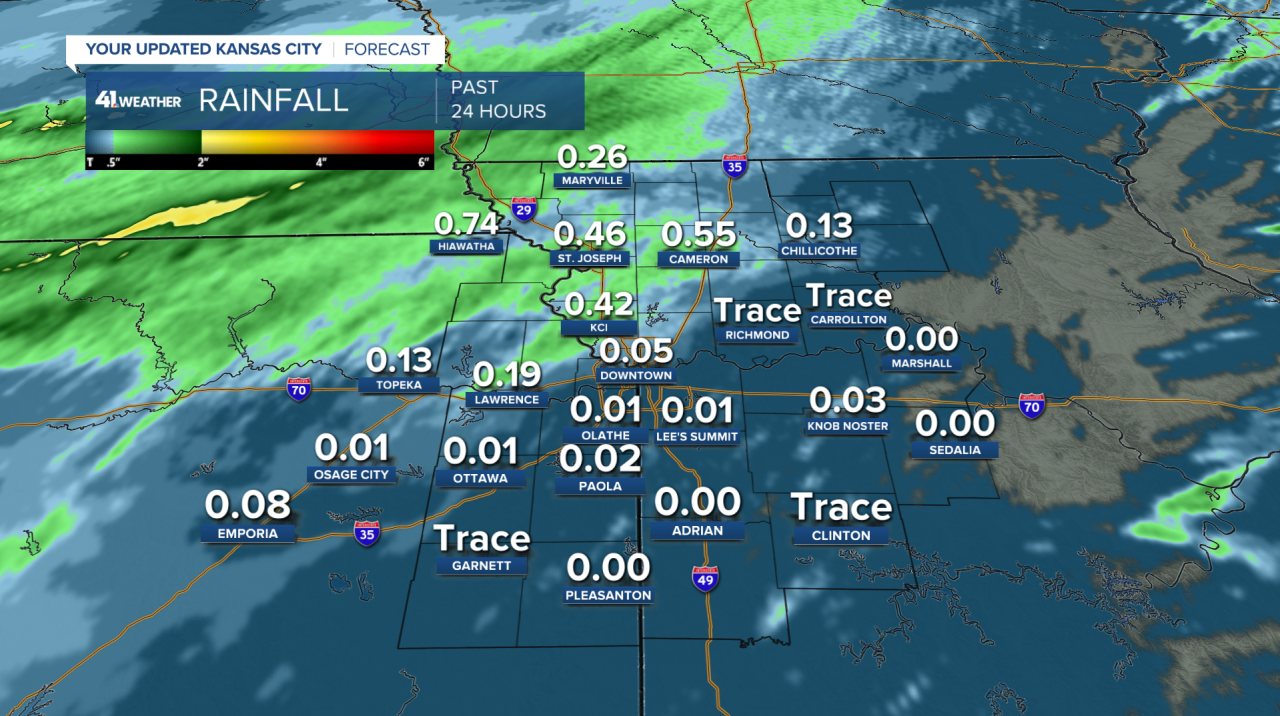
That was the perfect spot for the heavy rain as the drought monitor indicates the soil is driest in northwestern Missouri and northeastern Kansas. Where it’s even drier in south-central Kansas, heavy rainfall moved through last night.

More rain is coming Sunday but likely won’t make it to Kansas City, staying in southern Missouri where they could use a little rainfall as well.
It will probably be partly to mostly cloudy locally with high clouds hanging overhead and temperatures in the 60s.

On Monday the southerly wind returns, which means warm moist air will surge north from the Gulf of Mexico.
It’s May, meaning any lift/front nearby can generate strong to severe storms. There will be a front approaching from the west on Monday evening. Ahead of that front supercell storms will form in central Kansas and Oklahoma capable of big hail, tornadoes, damaging wind gusts, flash flooding...everything.
Into Monday evening and night, those storms may form into a line or a few smaller lines and move through KC.
By the time storms make it to Kansas City, they may be capable of widespread damaging wind gusts, embedded tornadoes (not very easy to see), hail, and flash flooding.

These embedded tornadoes called “mesovortices” spin up with a line of storms. They can develop and fall apart quickly and jump around the line, making them difficult to predict compared to supercells.
The timeframe for these storms is uncertain with a wide arrival window of 7 pm-1 am.
The earlier the storms arrive, they're more likely to produce large hail.

We are under a level 3 threat in eastern Kansas and a level 2 threat in western Missouri. Rainfall amounts look like 1-3" which may lead to flash flooding overnight.
More storms are possible Tuesday night-Wednesday which also could be strong south of the Kansas City metro.
Have a great rest of your weekend.
