


KANSAS CITY, Mo. — Good afternoon weather blog readers!
I hope you have enjoyed the cooler and cloudy morning brought to by the showers and thunderstorms that moved through earlier today.
None of that activity was severe, although it did have some heavy downpours with it. We’re waiting to see how much the atmosphere can recover this afternoon or how much sunshine we can get to break through the clouds.

The more sunshine we get the more evaporation and humidity will get back into the atmosphere to help feed thunderstorms that may develop later this evening.
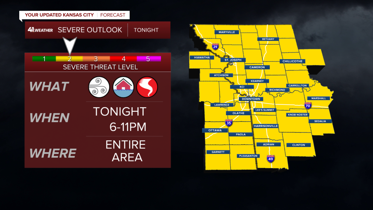
We’re still monitoring the chance for severe weather generally from 6 to 11 p.m. for the threat of damaging wind gusts, some flash flooding, and maybe a tornado or two. Hail is also possible but this doesn't appear to be a large hail setup.
We don’t necessarily need the sunshine for the severe weather threat to materialize, but it would help enhance any storms.

So far this morning, many of our short-term, weather models do not appear to favor the evening storms developing. Unfortunately, those short-term weather models seem to not be very reliable lately so it’s hard to believe what they are saying, more than a few hours in advance. So this is turning into a wait-and-see situation.
The entire area remains in a level two out of five severe threat including the chance of tornadoes in the Kansas City metro and to the northwest.
In any event, a cold front will come through this evening and bring in a cooler air mass for the weekend for the Kansas City area, we may not feel very cool and comfortable on Saturday, but it will overall be a decent summer day with heat indices in the lower 90s. Perfect pool or lake weather!
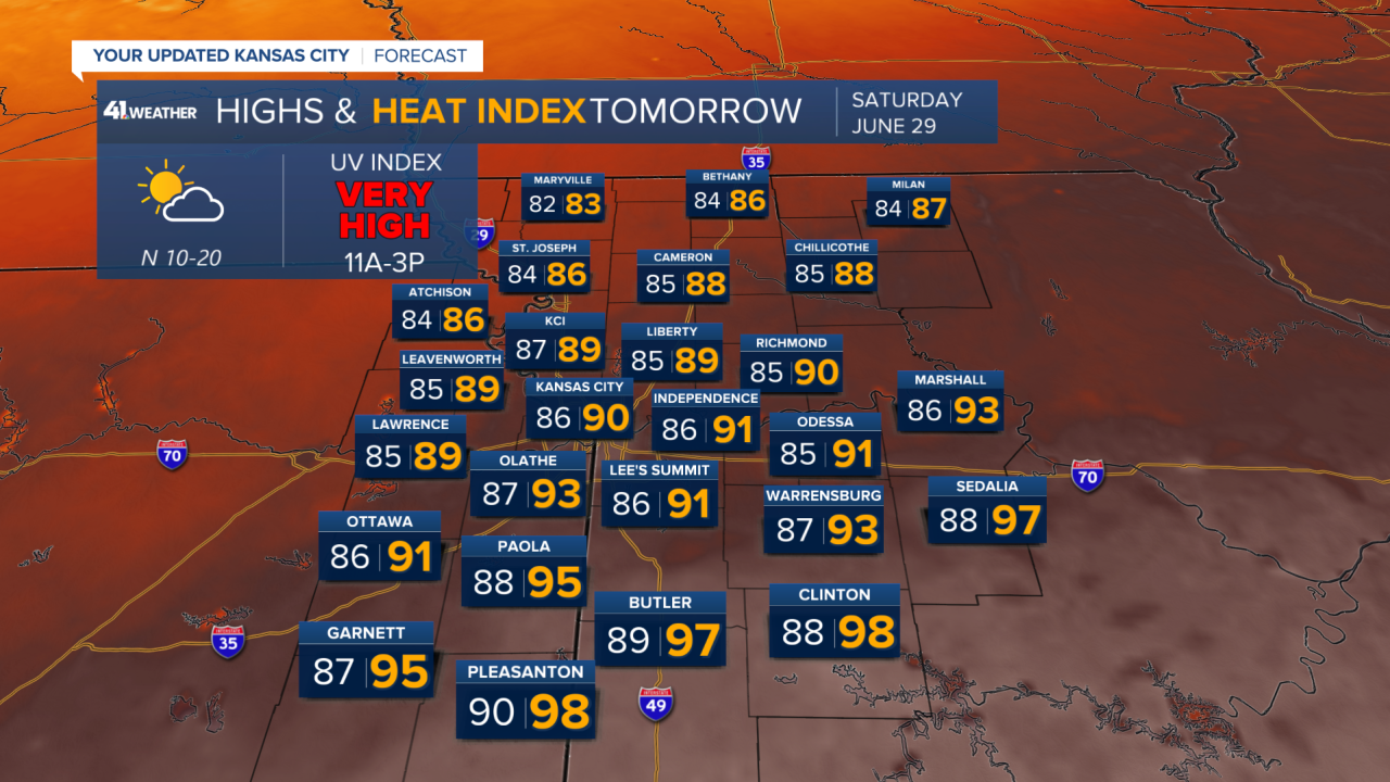
Where the front lingers around south of the Kansas City metro some scattered thunderstorms are possible and it will be much more hot and humid with heat indices close to 100 and places like Clinton, Sedalia, and Butler.
By Sunday morning, that cooler and dryer air mass will sweep through the entire area, and morning temperatures will range from the upper 50s in northern Missouri to the lower to middle 60s in the Kansas City metro. That will be a refreshing change from some of the cooler, rainy mornings we have experienced. The weather on Sunday looks perfect highs close to 80° mostly sunny skies low humidity.

By Monday, however, the heat the humidity, and the thunderstorm chances return. We may see heat and disease in the lower 100s again by Tuesday.
