


Good morning, weather blog readers —
We woke up to a few inches of snow on the ground this morning after a band of snow gradually moved north to south across the area overnight.
After a lull in the snowfall this morning, we expect consistent fine and light snow to fall through the afternoon and evening. The snow will taper off from west to east between 7-10 p.m.
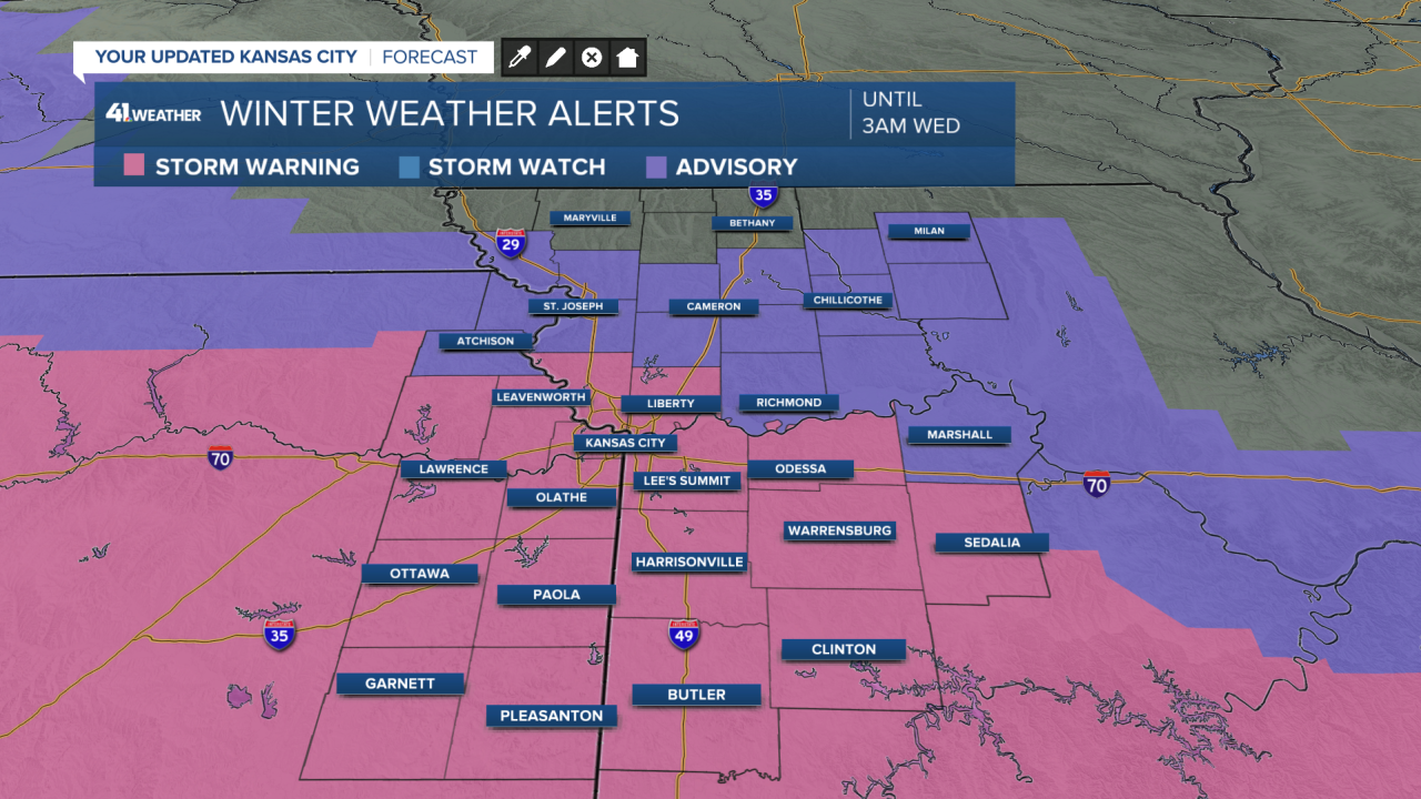
This will bring an additional 1-3" of accumulation across the metro area, with higher amounts of 2-5" south. Far less is expected north of I-70 with only a trace-1" possible.

A winter storm warning and a winter weather advisory are in effect until 3 a.m. Wednesday, but the snow will likely be long gone by then.
This snow is very light and fluffy, making it a little easier to shovel. If you have a powerful enough leaf blower, you might even be able to use it to clear your driveway.
As you're clearing your driveway, make sure you're using ice melt with calcium or magnesium chloride. These salts are capable of melting snow and ice at these bitterly cold temperatures.
It's so cold we may set six new record temperatures over the next four days. Some of these records are a bit confusing, but we are likely going to set record-cold high and low temperatures, especially on Wednesday and Thursday.

Currently, we are under a cold weather advisory until Wednesday evening, which will likely be upgraded to an extreme cold warning for Wednesday night and Thursday.

Wind chill values will be near -20 to -25 degrees for the next three mornings and possibly won't get above zero until Thursday afternoon at the earliest, or perhaps Friday afternoon at the latest.

When the wind chill is -25, frostbite can develop in 30-45 minutes on exposed skin.
The good news is that by the weekend and next week, temperatures will be in the 50s, approaching 60. Something to look forward to!
Stay safe and warm, everyone!
—
