Good Saturday Chiefs fan and blog readers —
The sun is up and those golden rays are highlighting a beautiful weekend forecast for Chiefs Kingdom.
The sun is up and those golden rays are highlighting @GEHAField in all its glory. Today’s forecast isn’t in Fahrenheit or Celsius but Travis Kelce-sius with a high of 87°. Are you ready Chiefs Kingdom?!?!?!?! @KSHB41 @Chiefs @tkelce pic.twitter.com/DkZDlAeyEV
— ☀️ Cassie Wilson (@CassieKSHB) August 17, 2024
As you get ready to roll into the parking lot at GEHA Field at Arrowhead Stadium for the first time this season, be prepared for lots of sunshine and solid humidity out there.
Instead of using Fahrenheit or Celsius for our temperatures today, we are going with a Travis Kelce-sius forecast at 87 degrees.
In order to convert to that you need the multiply by two Super Bowl rings, add in the swiftie effect, and then subtract the mustache. (personal preference, sorry Trav)
TK°=2xSB + TSE - M


It's a busy sports day for Kansas City with the Monarchs hitting off at 6:35 p.m. tonight and the KC Current playing a friendly match at 7 p.m.
Those evening games are going to be really nice as temperatures cool into the low 80s after sunset.

Now the humidity is going to stick around for a few days, but there is a little relief around the corner by Tuesday.
This is when temperatures look to flirt with maybe some upper 70s around the region.

As we look ahead to Sunday, there is a quick clip of showers to watch for as another system is ejected from the Rockies.
This is a surfaced-based system that won't have a lot of time or energy to get much going, but some light rain could push near the Kansas City area.
Here is what radar could look like by 7 a.m. and then again by 3 p.m. tomorrow.

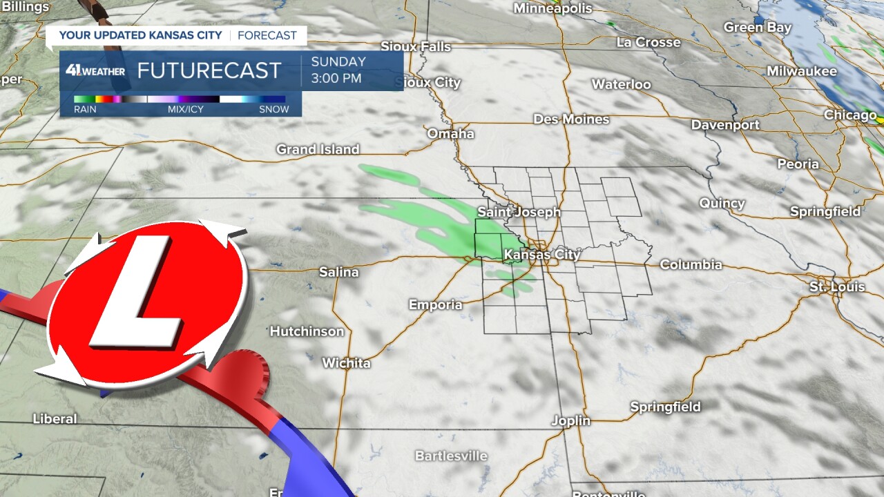
It shouldn't ruin your day my any means, but expect a slight cool down of temperatures Sunday with some more cloud cover across the region.
We are looking to hold in this NW flow pattern as high pressure builds to our west.
This means and system that ejects from the Rockies will make a clip near Kansas City.
Right now, that path doesn't include us for the next 10 days or so but that could change and a little wiggle would bring us into a more unsettled pattern.

Into next week, expect below average temperatures and dry weather until the end of the week.
Then the heat will slowly creep back into the forecast with 90s on tap for next week.

Since we aren't looking to the skies for any rain for a while, why not look up at the stars?
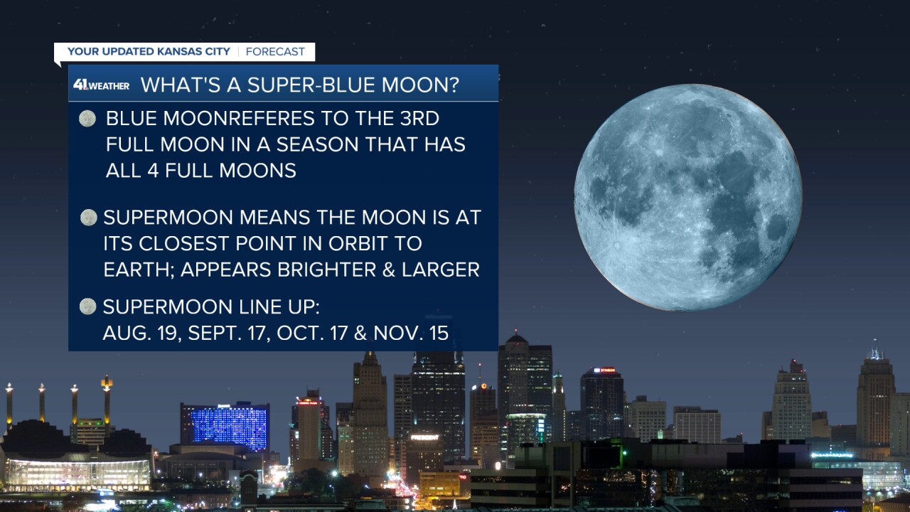
We've got our full moon rising Monday night and it marks the beginning of a series of super moons as we head into the fall.
It will also be a blue moon, and no this does not mean it will look blue.
Although being a super moon will make it appear brighter and larger, the denotation of a blue moon is just a counting thing.