


Did you enjoy the cooler air today?
Unfortunately, it did come with some storms this morning that produced damaging wind gusts from Topeka to Columbia.

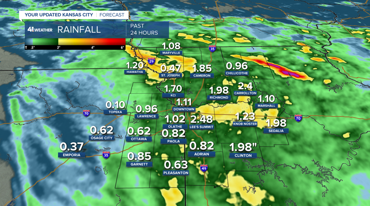
We picked up one to three inches of rain area-wide from Wednesday morning's downpour.
That much rainfall means you won't need to water your lawn or garden as much this week, as we typically need 1.5 to 2.0 inches weekly to keep things green.
We'll wake up to temperatures in the middle to upper 60s on Thursday morning, similar to Wednesday's comfortable conditions.
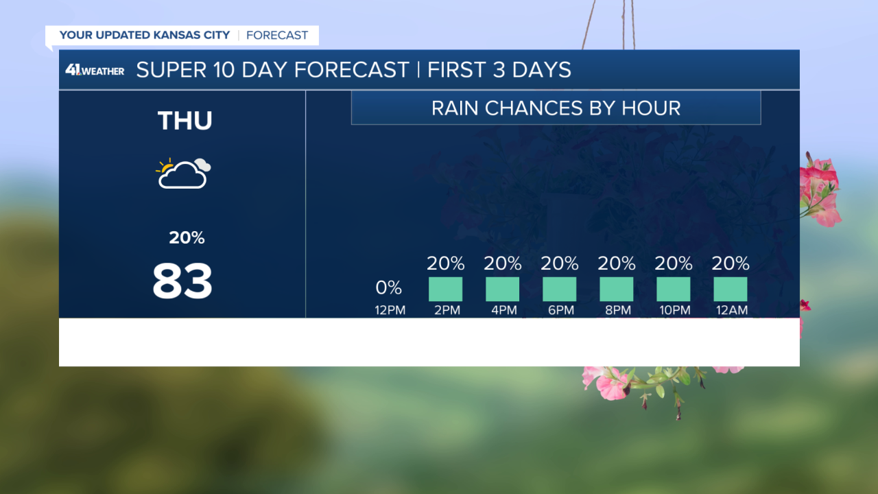
A disturbance from the west will track through and may bring us some light rain showers throughout the afternoon.
It will at least be a partly to mostly cloudy day, helping keep temperatures in the lower to middle 80s for highs.
Overall, a comfortable day compared to Monday and Tuesday.
Thursday night brings a return of showers and storms to the area.
Rain likely begins after midnight and lasts until mid-morning Friday, driven by a lifting warm front.
That means Friday will be hotter and more humid with heat indices returning to the 95-100 range area-wide.
The quicker the rain moves out in the morning; the sooner temperatures will climb and the hotter it will be by Friday evening.
And the more likely our second round of rain Friday evening will be severe.
We are under a Level 2 (out of 5) threat of severe weather with damaging wind gusts, flash flooding, and a tornado as the main concerns.
Hail from these storms would be small.
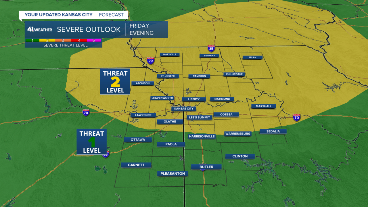
Timing for this second round of storms would be after 7 p.m. Friday.
Expect some lingering rain showers possibly early Saturday morning, before 7 a.m., but otherwise, Saturday will be dry.
The cooler air won't quite settle across the area on Friday, as the heat index in the southern KC area and south may still be 95-100.
Further north, heat index readings may be in the upper 80s to near 90.
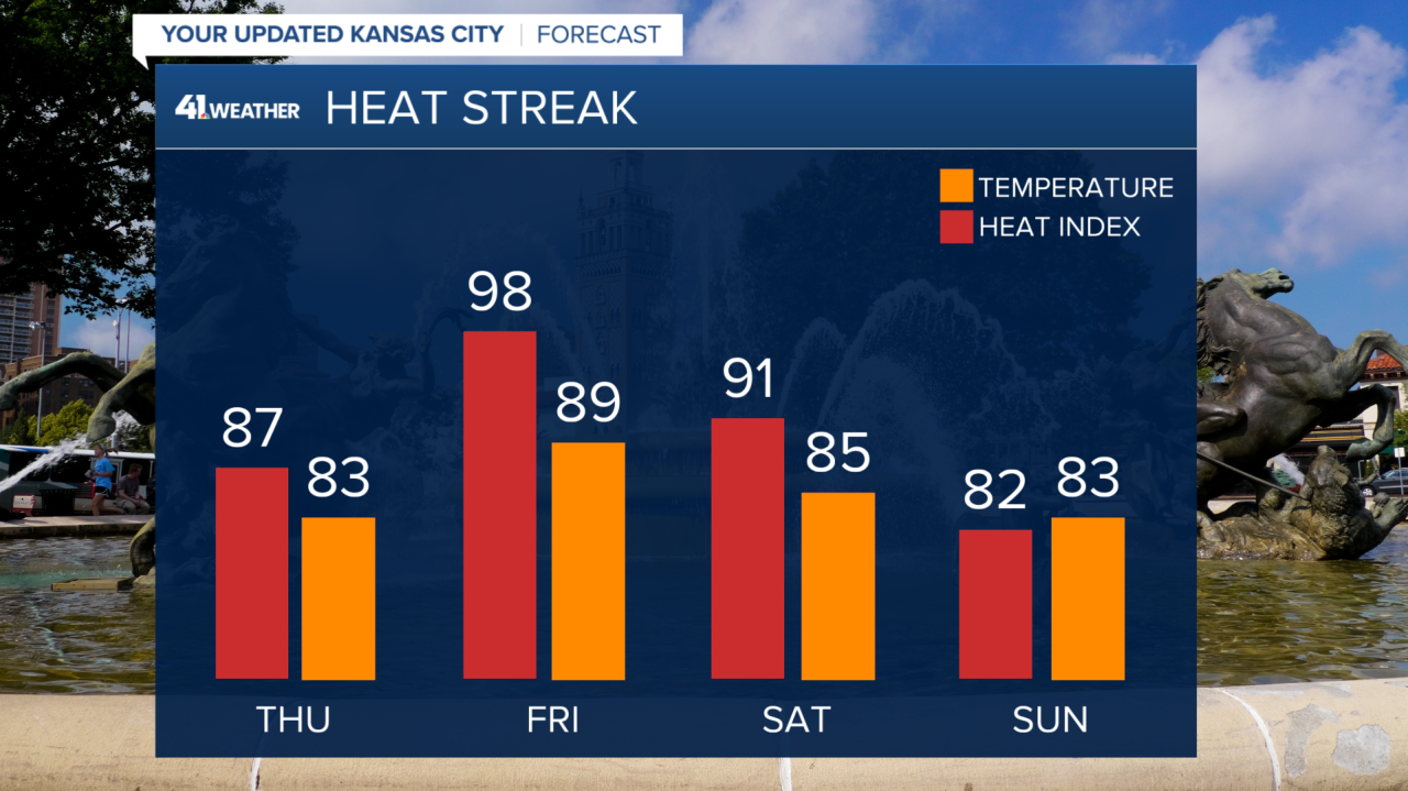
Sunday is the best day of the weekend by far.
Cooler, drier air arrives area-wide as morning temperatures fall into the low to middle 60s and afternoon highs climb into the low to middle 80s.
So get the yard work and afternoon plans made for Sunday.
—
