


Good Thursday morning, weather blog readers!
We went to bed last night to thunderstorms and woke up to more. This is a pretty common summer setup as warm air and moisture allow for rain to quickly develop.
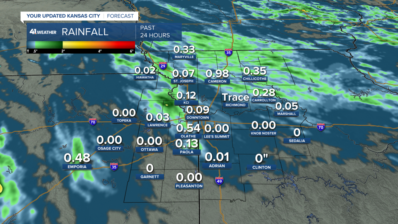
Our jet stream sends down areas of spin/vorticity that interact with mini cold fronts/boundaries and push them around to create rain. This pattern will continue each evening through Saturday with lingering rain through the following morning.

There is a lot of energy for storms to use during the afternoon so if they
can develop before sunset, we may see some severe storms.
The tricky part is finding these fronts set up each day which will tell us what area has the best chance of rain. Generally, we all have a moderate rain chance through Saturday morning.
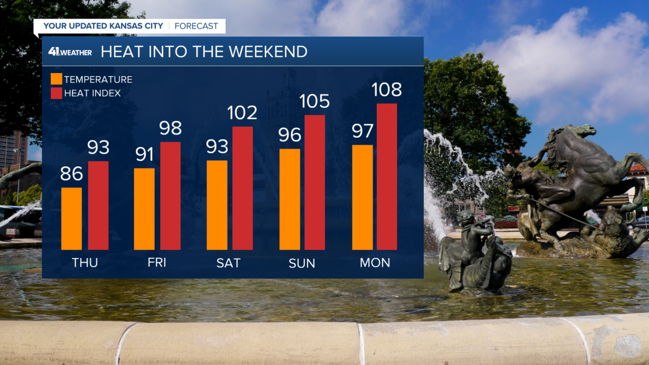
Brace yourselves for a short heatwave.
Highs and heat indices each day will increase into the weekend. Thursday highs will be in the middle 80s reaching the middle to upper 90s by Sunday.
If the last few months were dry and the ground was parched, temperatures could be even hotter.
During this heat wave, afternoon heat indices will be 105-110 with overnight temperatures near 80..which means your air conditioner won't get much of a break.
Be sure to take heat precautions outside from 11 am-4 pm during the hottest part of the day when the sun is strongest. And check on your neighbors and make sure your pets are staying cool!
Thankfully this won't be a very long heatwave, only lasting from Sunday-Tuesday followed by a cold front.

