

Good morning, everyone —
I hope you made it through the fifth episode of snowfall this winter safely.
Since November, we have officially received exactly 20 inches of snow in Kansas City. The Monday-Tuesday storm dropped 3.2 inches of accumulation.
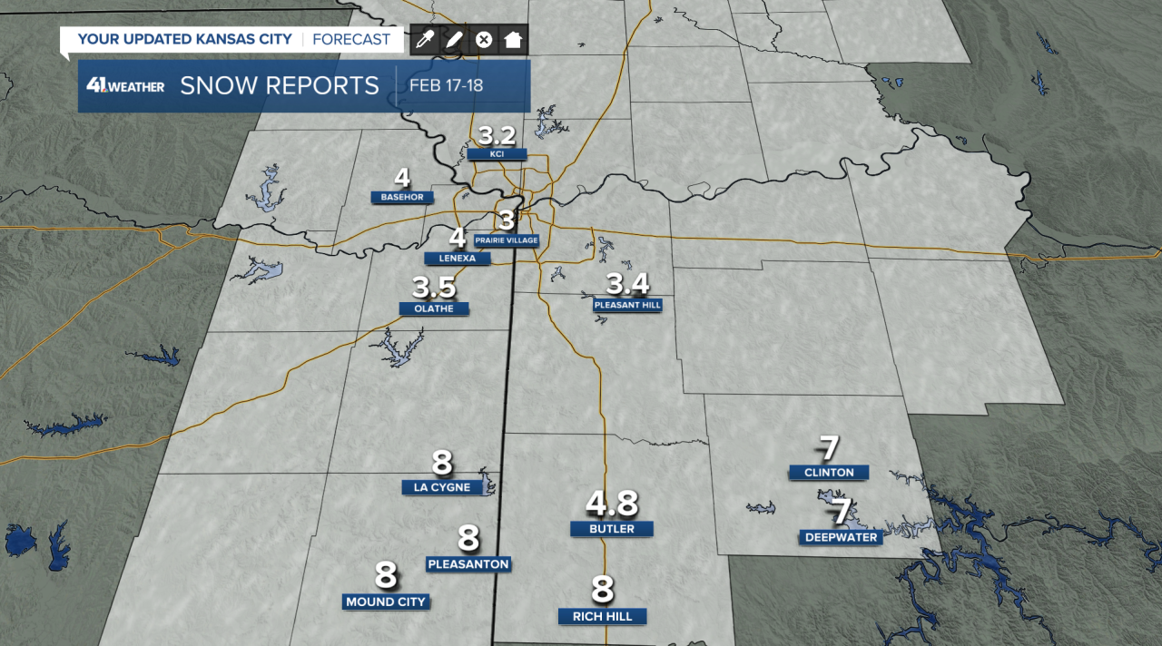
The highest totals were down near Rich Hill and Pleasanton, where 8 inches was measured. There weren't many snow reports with this storm; I don't think anyone wanted to go outside and measure snow for 5 minutes, ha!
These totals fell within our forecast range of 3-6 inches for the entire metro and 6-8 inches south.
That snow, unfortunately, reinforces the cold air mass that has slid over much of the U.S. from the Arctic.
On Tuesday, we set a record cold high temperature of 4 degrees, beating the previous record of 11 from 1936.

And that is probably the first of many records to fall through Friday. In this graphic, white numbers are the forecast and purple are the records. We may break six more records through Friday.
If we can bear through these few days of brutal cold, we will be rewarded with very comfortable temperatures.

A cold weather advisory continues through noon Thursday as wind chills tomorrow may be the coldest of this entire cold snap, near -25 or lower.

Weekend highs will be in the 30s and 40s, followed by highs near 60 next week!
A cold front and storm system may make our forecast a little interesting on Wednesday and Thursday. It may be just cold enough for some light wintry weather on Thursday morning. The chances of that happening right now are low.
The temperature setup next week isn't very good for any type of wintry weather.
Stay safe!
