


Happy Monday, blog readers —
It's Victory Monday in Kansas City, but boy do we need a win in the rain department!
We haven't seen a raindrop in 26 days, and in order to officially break this dry spell, we need to register 0.01" of rain at KCI.
We have NEVER moved through an October without seeing at least a drop of rain!
Take a look at some of these stats Lindsey Anderson pulled this morning.

So far this year is the driest, beating the Dust Bowl where we saw 1.88" of rain during the month of October.
In a normal October, the Kansas City area usually reports 3.25" of rain.
This dry spell comes on the heels of the 53rd driest summer in KC history, so it should come as no surprise that our drought monitor has been taking a dive this fall.
Portions of the metro are now in a severe drought, and some of southeast Kansas and southwest Missouri are now in extreme drought.

But can we break this dry streak?
There are two — maybe three — rain chances to talk about as we move through the rest of October.
Chance #1: Tonight
There is a weak low-pressure system currently pulsing some rain through central Kansas.
As this system moves toward us, we will mainly deal with breezy conditions and another push of warmth.
But overnight, there is a small chance for rain. It's not great, but it is something.

This system looks to use up the little moisture it has before it reaches Kansas City, but we might be able to pick up a few sprinkles and trace rain in some spots.

This system doesn't get my hopes up for breaking our dry streak, but remember, we only need 0.01" of rain to technically pump the breaks.
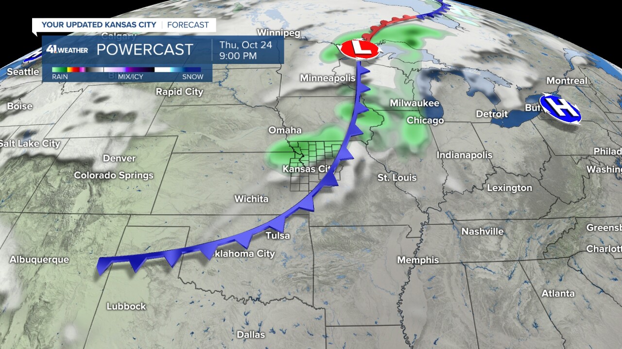
So if it doesn't happen tonight, we are looking at Thursday.
Chance #2: Thursday Night
The next system eyeing the Plains is a dry cold front Tuesday into Wednesday.
The main trend for this week continues to be these oscillating temperatures. The warm side of this swing keeps up 10-15° above normal, and the cool side really isn't all that cool.
The normal for this time of year is 66°, and on the back side of this dry front, we are still above average.

Thursday's front isn't completely dry, though! It's a tad stronger and looks to try and break down the dry pattern a little better.
This system will slide through the upper Great Plains and drop a cold front through Kansas City Thursday night into Friday, bringing us cooler temperatures for the weekend but also maybe 0.10-0.25" of rain as well.
Right now, the better chances for rain are north of Interstate 70.
But what if this fizzles out? Well, then we are watching possibly a bigger pattern change around Halloween.
Chance #3: Halloween Week
Models have been hinting at a significant pattern change by the end of October, around Oct. 28 to Nov. 1.
This looks like a bigger low that will bring wet weather to the Pacific Northwest leading up to Halloween.
Then, if we completely get rid of this dry ridge situation, we will refuel that low as it moves toward Kansas City.
If this happens, then we will be talking about a solid rain chance, maybe even thunderstorms and a significant cooldown into early November.
The timing of this might correspond with trick-or-treating, so you know we will be watching this system very closely with each model run!
This could be rough timing for us, but just know there is still so much uncertainty with this pattern change.

—
