Happy Friday, weather blog readers!
We are ending this week with soggy ground after we received 2.39 inches of rain officially at KCI.
Even without the rainfall on Thursday, we are only left with a few patches of abnormally dry or moderate drought.

The weather today has been great after starting with some fog this morning; temperatures have warmed into the lower to middle 70s.
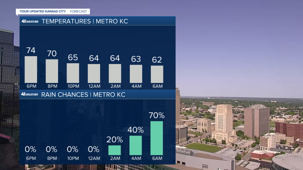
It should be a comfortably cool evening as we cool off into the 60s overnight as clouds increase along with rain chances.

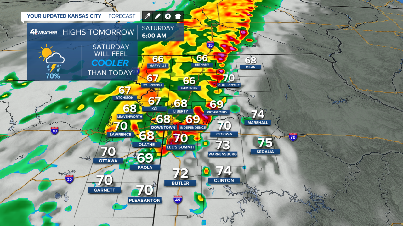
A line of storms is poised to move through between 5-8 a.m. with the threat of strong wind gusts, some hail, and of course thunder and lightning.
Some occasional light rain showers are possible until noon before the skies clear out in the afternoon.

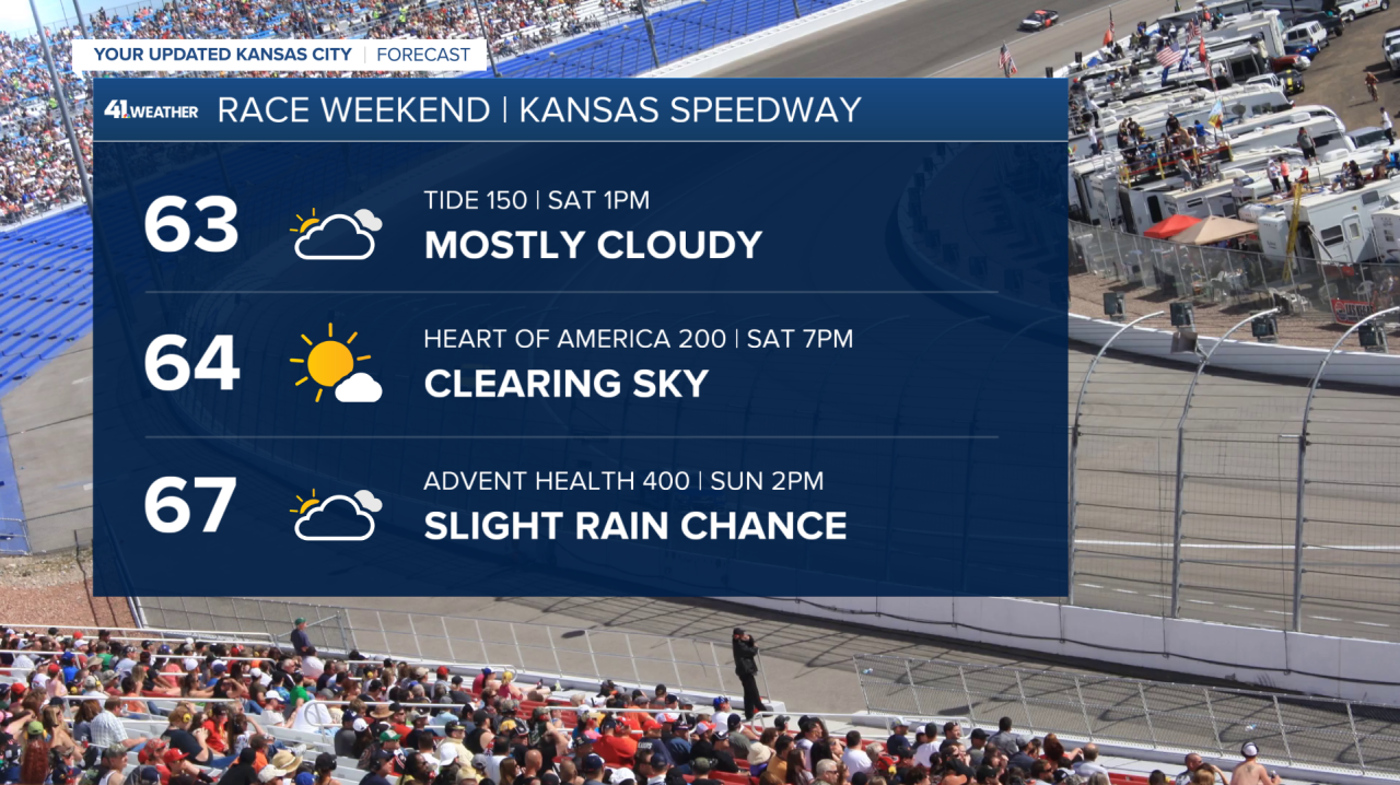
That means good weather for Saturday baseball and NASCAR races, but please watch out for strong winds Saturday morning if you’re camping out.
We could pick up another 0.25-0.50 inches of rainfall.
We don’t need rain but if the amounts are low, we’ll take it.

On Sunday, another system will try to sneak in from the south.
Most of our weather models keep the rain south of Interstate 70, but one has been persistent in bringing the rain into the Kansas City area in the afternoon.

If that happens, the NASCAR race may be impacted, but likely not the Royals game as the chance of lightning is low.

Rainfall amounts with this round look light if it gets further north, 0.10-0.25 inches.
We will do our best to dry out before the next chance of heavy rain and storms coming Monday night.
A line of storms could bring damaging winds, hail, and up to an additional 2 inches of rain.
—


