


KANSAS CITY, Mo — Happy Friday, weather blog readers!
First off for the hot weather lovers, I want to apologize for how terrible the weather is. I know many of you prefer the weather to be 90, sunny and humid in August.
I regret to inform you that it just hasn’t been happening lately and won’t this weekend. So please send your angry words to wes.peery@kshb.com. I’m doing this as a public service to help you through this tough time of comfortable temperatures and lower utility bills.
OK, getting serious now.
This morning, temperatures reached a record low of 54 in Kansas City, beating the previous record low temperature of 55 set back in 1927. This happened because the sky cleared out overnight and was covered back up with clouds Friday morning.
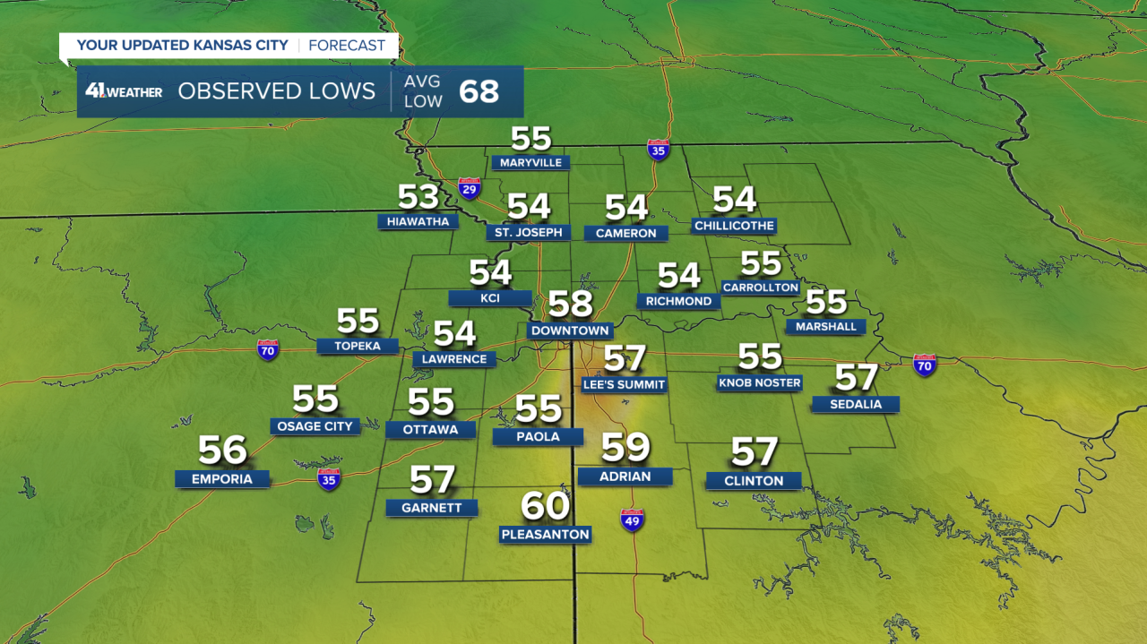
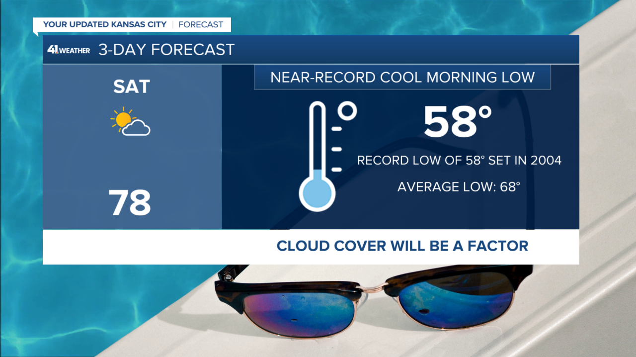
Another record-low temperature is possible again on Saturday morning. The record is 58, our forecast is 58. What a fantastic couple of mornings as we have just come off the historically hottest time of year.
So why is it so cold? Because the air is flowing in from the north, way north..the Arctic. Check out this atmospheric flow map that shows the wind in the middle part of the atmosphere flowing in from the Arctic Circle.
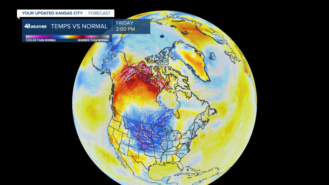
Imagine how cold it would be if this were January. BRRR.
Temperatures for the rest of Friday will be in the upper 60s to lower 70s with high clouds and maybe some sprinkles but the air is too dry for legitimate rain showers. If we don't get warmer than 73 then a new record-cold high temperature will be set too.
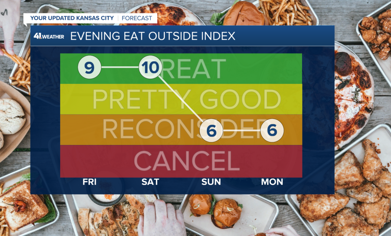
I’m giving Friday evening a 9 out of 10 on the Eat Outside Index because it will be so chilly in the 60s!
Saturday afternoon looks great, partly cloudy skies with highs in the upper 70s.
Clouds and rain chances arrive on Sunday. Rain may begin late in the morning and be around for most of the day. The longer it rains, the cooler temperatures will be likely in the 70s throughout the day.

So outdoor plans should be made for Saturday as that will be the driest day of the weekend.
Looking to next week, temperatures will slowly return to warm-August standards gradually throughout the week with highs near 90 by Thursday and Friday. With daily showers and storm chances.

We will keep an eye on storms that can form on Wednesday and Thursday as they may be strong.
—
