


KANSAS CITY, Mo. — Hope you’re having a great Friday weather blog reader! We’re offically in the historical hottest part of the year which lasts until Aug. 2.
Up to this point, July, which is the hottest month of the year, has been much cooler than average. July 2024 currently sits as the 15th coolest on record. We are slightly cooler than last July.
We’ve only warmed above 95 once this summer when it hit 98 in June.
Temperatures will try to make a run at the middle to upper 90s next week but it will all depend on rain chances overnight and afternoon. Rain has been holding us back from achieving consistent high heat, cooling off the air via precipitation and keeping the ground relatively moist.
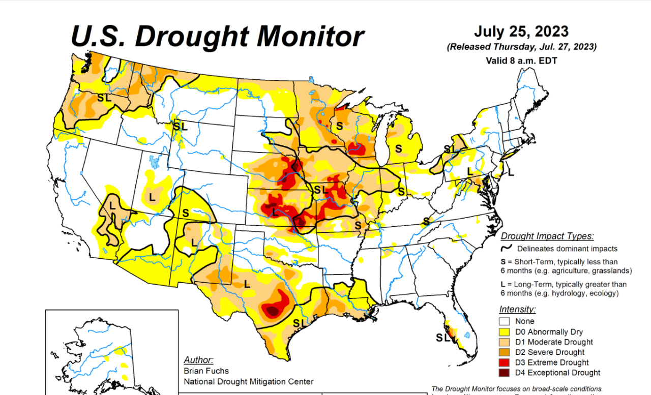
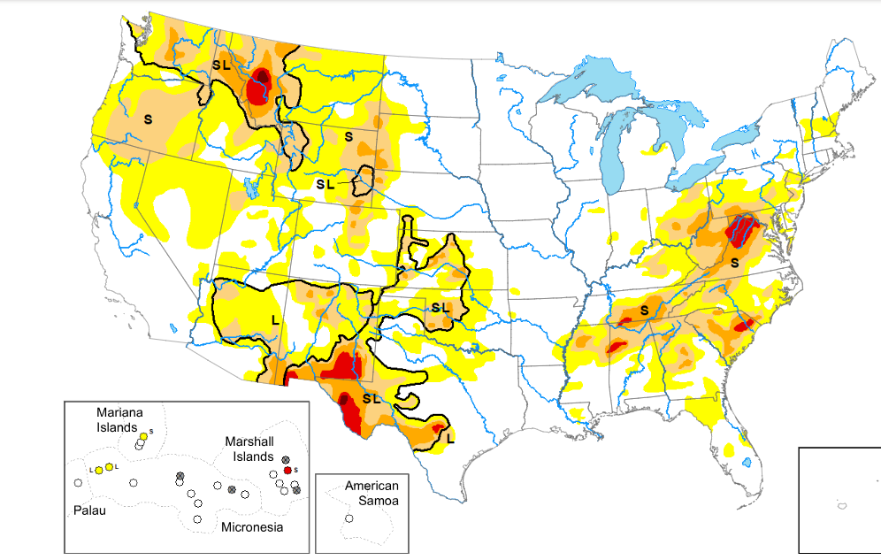
Have you noticed how green everything is...still? Look at the difference in the drought monitor from 2023 to 2024. Yellow to red is dry to very dry ground conditions, covering Missouri and Kansas in 2023.
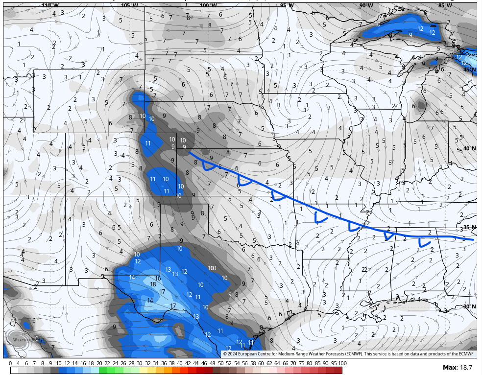
All this hot yet unsettled weather is caused by the jet stream. Western Missouri and eastern Kansas have ended up in northwesterly flow, notice the diagonal lines near Kansas City. This flow can send through storm complexes overnight that fizzle out in the morning. This flow also sends through areas of spin that reignite the morning storms later in the day.

Both of those can leave us with clouds, scattered storms and more moisture in the ground, which then evaporate back into the air. All processes work against the sun heating us to its full potential.
You may also be noticing your phone app is putting out very hot high temperatures next week...close to 100 for several days.
Go ahead and look now.
Your phone app is doing that because it’s a computer that doesn’t understand this weather pattern. While yes it may get in the upper 90s one of those days, it historically has been proved too difficult to get a string of high heat this year.
Don’t get me wrong it will still be hot with the heat index 100+ but this year the heat has struggled.

Based on our machine learning weather models, it looks like the heat will break next weekend with highs back in the 80s. The model below shows a cold front moving through Friday or Saturday. That makes sense with the weather pattern this year too.
The moral of the story is yes it will be hot next week, but your phone forecast is likely misleading.
