Good morning bloggers,
Happy Veterans Day! Today we celebrate our Veterans. Thank you for serving and for helping keep us all safe!
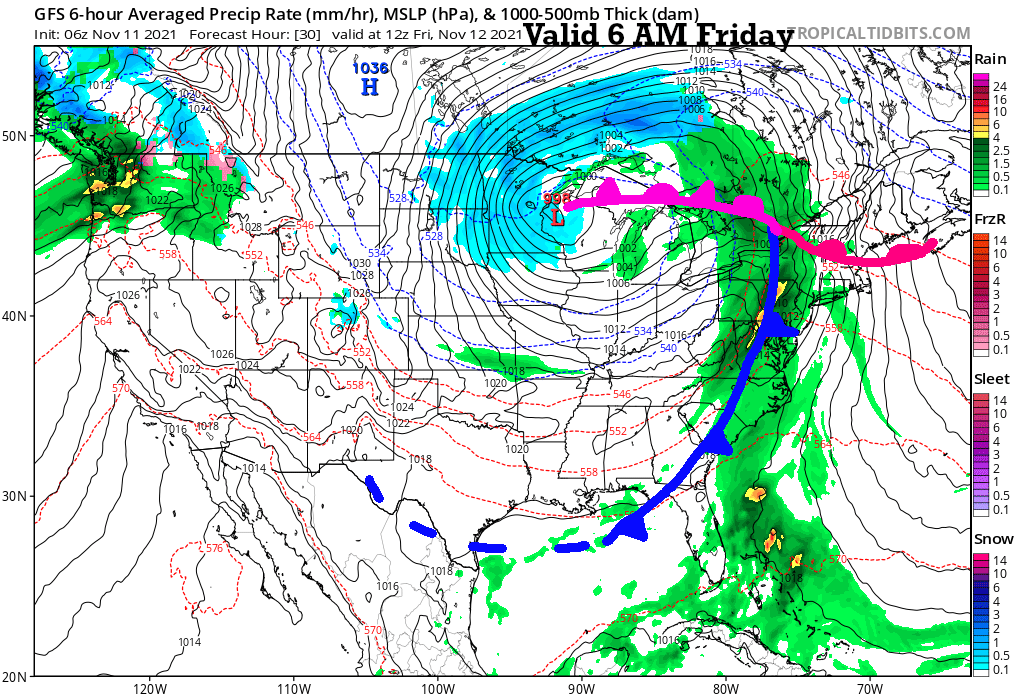
The storm system is maturing near the USA/Canada border today. This is the storm system that brought us November thunderstorms, heavy rain, lightning, thunder, and some strong wind gusts overnight. We are going into the part of the storm that will be causing west winds and 100% sunshine today:

- This will produce cold wind chills by Friday morning
- Expect the wind to shift from the west today to the northwest tomorrow
- Low clouds will increase early Friday and these clouds will likely get very extensive and it may trap in the colder air with a high temperature near 39 degrees tomorrow

These are the rainfall totals as of 10:22 PM last night. The rain was just about over in the KC metro area, but the amounts off to the east were still adding up. It was a nice soaking rain.
Here is a look at today's surface forecast map showing the intensifying storm near the USA/Canada border:

It will warm up into the middle 50s today. Have that wind breaker ready. The ups and downs will result in a roller-coaster ride of temperatures in the next week. We will go in-depth on KSHB-41 today and tonight.
Thank you for sharing in this weather experience and reading the weather blog. Have a great day!!!!
Gary


