Good Chiefs Sunday bloggers,
The week is starting with some great weather on this unique Chiefs Sunday. Frankfurt, Germany is seeing a few rain showers with highs in the 50s. I believe they have covered what is usually an open stadium which is a good idea as there are lingering rain showers after the most recent storm. It has been a stormy a few weeks in Europe with flooding in northern Italy.


Mother Nature is a Chiefs fan with red clouds during the sunrise.


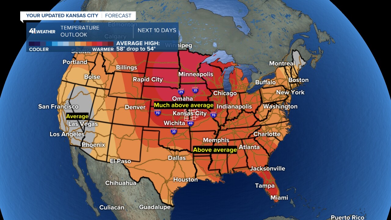
We will be in a rather calm pattern the next seven-10 days as systems track quickly west to east from the Pacific to Atlantic Oceans as they cross the USA.
This means two things.
1. There will be little to no rainfall as the systems do not get a chance to organize or pick up decent moisture from the Gulf of Mexico in time to bring much rain west of the Mississippi River.

2. Temperatures will run well above average as the fast west to east flow keeps the Arctic air bottled up in central and northern Canada. Much above average means around 5 to 15 degrees above average. The entire country will basically see above to much above average temperatures.

Here is the day by day forecast through Friday.
TODAY:
A south breeze will increase to 10-20 mph taking highs to the mid and upper 60s under a partly cloudy sky. It may feel a bit humid as well as the winds bring in some Gulf of Mexico moisture (not enough for rain).

MONDAY:
A weak front will stall just north of KC allowing our high to reach around 70°, perhaps a few degrees warmer. There will be a lot of high clouds and that is why we may not see highs higher than 70°.

TUESDAY:
The front heads back north as a warm front, allowing our highs to reach the low 70s. Highs will be in the 80s across Oklahoma.

WEDNESDAY:
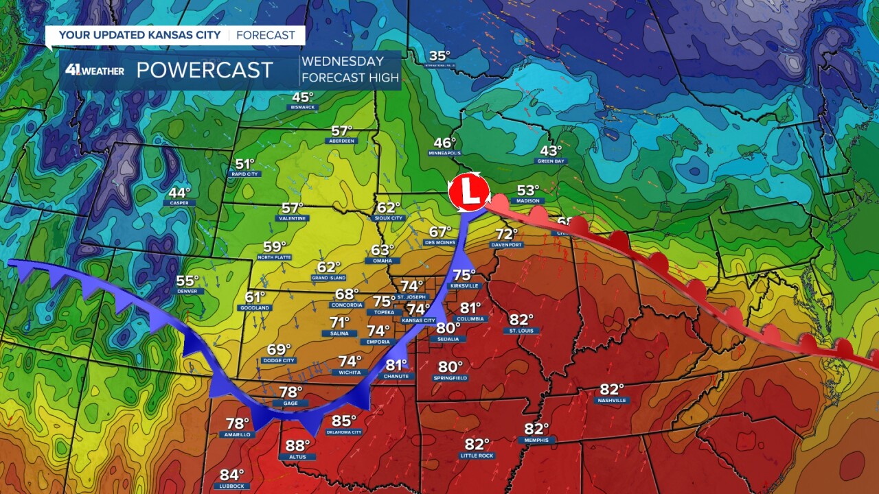
A cold front will be moving through. At this time we are going for a high in the upper 60s. But, the new data has us at 74°. If the front is slower, we will easily reach the mid 70s. Central and eastern Missouri will see highs 80°-85° as the front will not reach there until evening! Record highs here next week are basically between 78° and 82°. We are getting close.
Also, look at the highs in the "colder" air behind the front in South Dakota. Highs are in the 50s to near 60°. This is not much of a front.

THURSDAY:
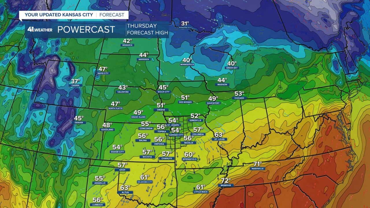
Since the front is weak, highs will be in the 50s. 54° might be too cool.

FRIDAY:
Highs will get close to 60°, if not warmer.

The next chance of a storm is between Nov. 15-20 as it stands now. And, it would be mostly rain as it stands now.

Have a great week ahead.
Stay healthy
GO CHIEFS!


