KANSAS CITY, Mo. — Good morning bloggers,
The total lunar eclipse was rather spectacular last night. The Earth passed between the moon and the sun and blocked most of the light from the moon. Enough light was able to get through to be able to still see the moon with the orange/red tint:

Thank you to Michael Bozeman in Lee's Summit who took this picture through his telescope. There were a few clouds affecting the viewing around the Kansas City area, but in the end, we did get to experience this total lunar eclipse last night as the clouds finally moved away by 11 p.m.
Here is another picture from Andy Caraway looking over downtown Kansas City:

The sky is clear this morning. It will be a gorgeous spring day. The first week of May was too cool. The second week of May was too hot. This third week of May should be just right! Temperatures will mostly be in the mid-70s to lower 80s with a few chances for showers and thunderstorms.

The forecast map for Tuesday, shown above, has a warm front south of Kansas City, or possibly north of Kansas City. The American Model (GFS model) has that broken warm front near the Missouri-Iowa border being the main front, whereas other models have the warm front southwest of Kansas City. The models that have it forming southwest of Kansas City have us in a heavy band of thunderstorms Tuesday. The models that show it farther north are drier near Kansas City and stormier in Nebraska and Iowa near that northern Missouri border.
Severe weather risks:


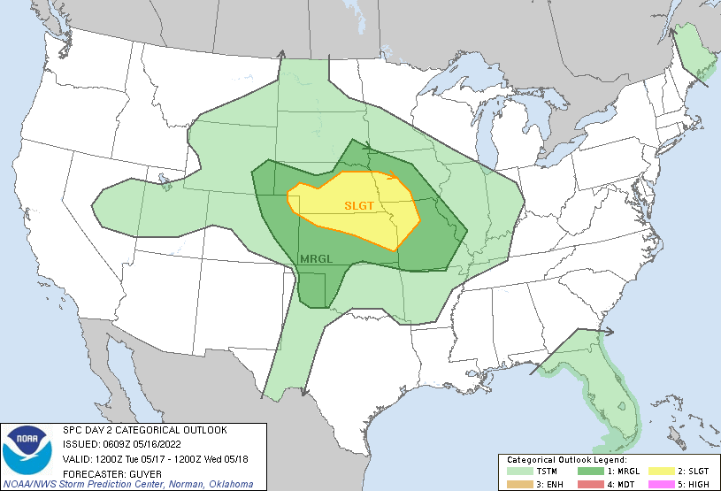
There is a risk of severe thunderstorms over the Texas Panhandle and eastern New Mexico today, and the risk expands over our region tomorrow. The main severe weather type expected would be large hail and damaging winds. We will wait and see how this sets up on Tuesday and we will learn more later today. Watch for our in-depth weather forecasts on KSHB 41 today and tonight.
Kansas City weather timeline:
- Today: Mostly sunny and very nice. Light winds with a high near 79 degrees
- Tonight: Clear and mild. Low: 58 degrees
- Tuesday: Partly cloudy with a chance of showers and thunderstorms. There is a level 2 out of 5 risk of severe thunderstorms. High: 79 degrees
Thank you for spending a few minutes of your day reading the weather blog and sharing in this weather experience.
Have a great start to the week,
Gary


