KANSAS CITY, Mo. — Good morning bloggers,
A strong storm system is developing and will impact the Western and Northern Plains first and then spread a chance of showers and thunderstorms our way Saturday and Saturday night.
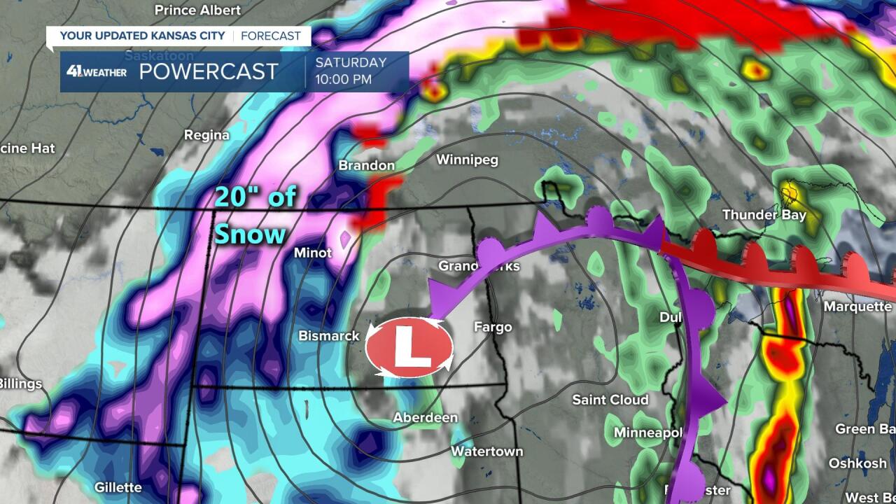
There is another blizzard and nearly a two-foot snowstorm predicted for North Dakota. I was on WDAY Radio on March 2 and predicted, "If not eastern North Dakota, then definitely western and central North Dakota," for this weekend. Here is a link to that entire broadcast discussing the LRC: LRC Prediction Verifying This Weekend
I will emphasize this again. I was on that radio show and we discussed the LRC, the cycling weather pattern of the Northern Hemisphere, and predicted major snowstorms for North Dakota in April, and picked out when they would happen. We also said this storm would produce a potential severe weather outbreak. Dean Wysocki is their meteorologist and we are teaching the farmers over the Northern Plains about how to use the LRC in their preparation for planting, growing and harvesting their crops.
Today, there is a level 3 out of 5 risk of severe weather for later today over the plains as you can see below:

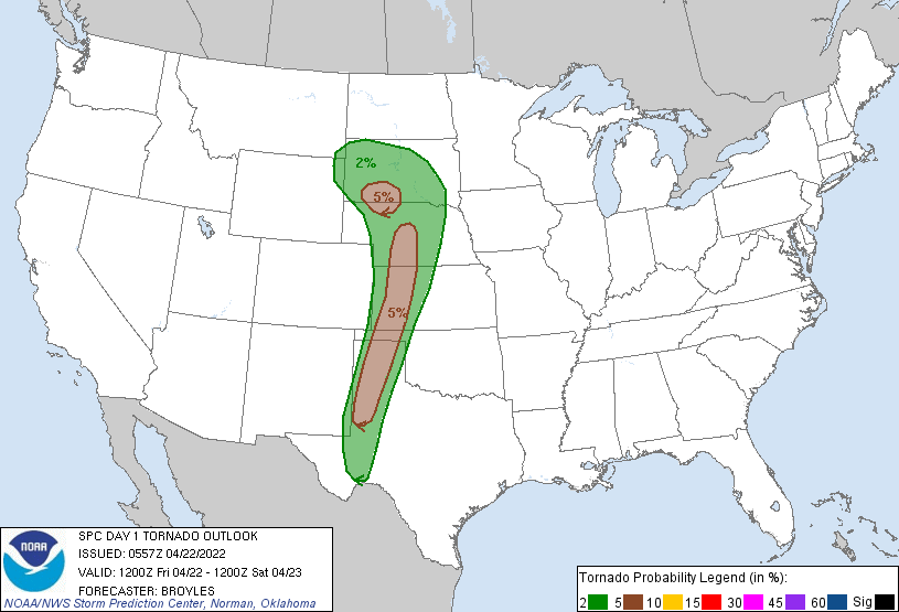
Here is the tornado risk today:

There is a "cap" that must break for thunderstorms to develop over western Kansas later today. We will monitor this closely, but for Kansas City, these have no risk of heading our way tonight. The risk will shift east on Saturday afternoon and night:

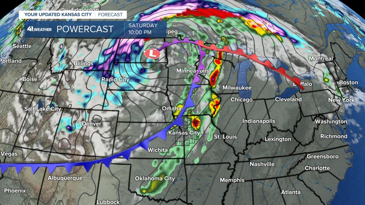
This storm will spin up and occlude into that slower-moving potential blizzard in the predicted western and central North Dakota region. This next map is the wide version of this storm and you can see a cold front approaching Kansas City at 10 p.m. Saturday:

Remember, we have now gone almost three years without a tornado watch in parts of our viewing area. This is highly likely the longest such streak in our history, but records of these watches only go back around 70 years. When conditions are favorable for severe thunderstorms that may produce tornadoes, the Storm Prediction Center will issue a watch for areas around a half state-wide. We have had a few small tornadoes with tornado warnings when they formed, but the broad conditions for a tornado watch have not come together for our region since May 28, 2019. I doubt one is issued again on Saturday, but we will have to pay close attention.
One of the factors that may limit our risk of severe weather is a large pocket of cooler air forecast to develop with thick clouds and possible light rain showers or weaker thunderstorms Saturday. Look at the temperature forecast by the NAM model for Saturday evening:

A large area of clouds is forecast to keep temperatures from warming into the 80s and there is a large area of 50s from Wichita stretching into Iowa. So, while the blizzard breaks out in North Dakota as predicted almost two months ago, this severe weather set-up also is right on schedule. Kansas City may once again find a way to avoid the worst part of this.
Now, if it is warmer and the sun breaks out Saturday afternoon, then this could change fast. Other ingredients are in place for severe weather, and this is why we are at that level 2 out of 5 risk tomorrow. We will be monitoring the sky closely.
- For today, get ready for some wind to be increasing and some sun to come out this afternoon which will warm us up to our forecast high of 83 degrees. Have a great Friday Night In The Big Town, and we will go in-depth in our weathercasts today and tonight.
Thank you for spending a few minutes of your day reading the weather blog and sharing this weather experience.
Have a great Friday,
Gary


