


Good morning bloggers,
Finally! We just had the most rain in a single day since June 21, when 1.42" fell. Wow! That is over four months ago during the warm season. That is a very long time for that time of the year.
Rainfall Amounts Estimated By Our Computer:
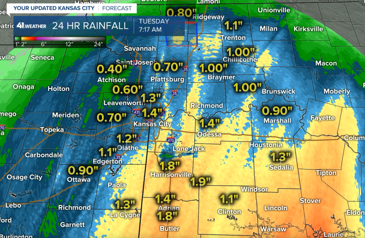
There were a few spots north and west of Kansas City that did not get the great soaking the rest of us did. But, we will take this widespread rain. It will help pop the trees with vibrant color as they were drought stressed. Let's see how they look the rest of the week as the sun comes back out.
A storm is moving by today:
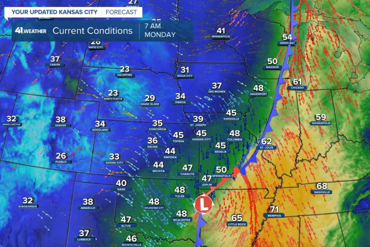
At 7:40 a.m. this morning, a low pressure area is centered near Fort Smith, Arkansas. Rain is spreading across areas just southeast of Kansas City as you can see below.
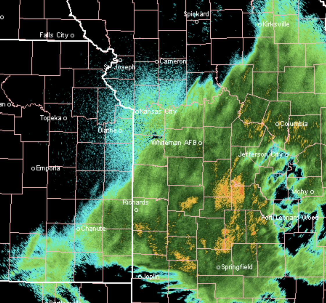
There may be a few drops or a misty drizzle as far northwest as Kansas City, but this main storm is tracking just southeast of KC. When this part of the pattern returns during the winter, this will likely be a large area of snow.
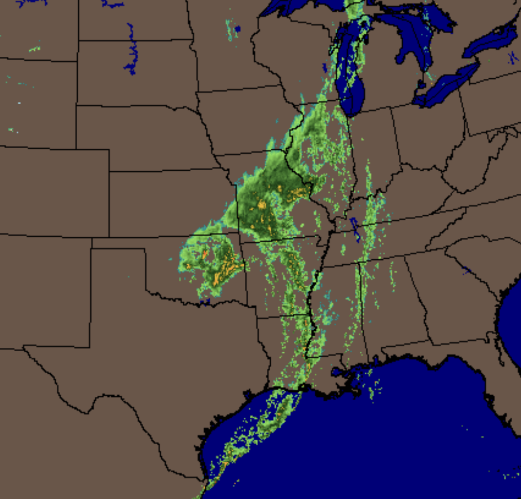
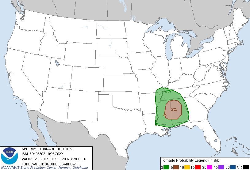
Look at the comma shape around this storm. Severe thunderstorms are possible today over the southeastern United States. There is a 5% chance of a tornado within 25 miles of any spot near the eastern Mississippi/western Alabama region:
For KC, the weather is about to calm down and dry out again. The sun will return later today and Wednesday. Expect it to be in the 40s reaching into the 50s where the sunshine returns.
Thank you for sharing in this weather experience and spending a few minutes on the weather blog.
Have a terrific Tuesday,
Gary
