KANSAS CITY, Mo. — Good morning bloggers,
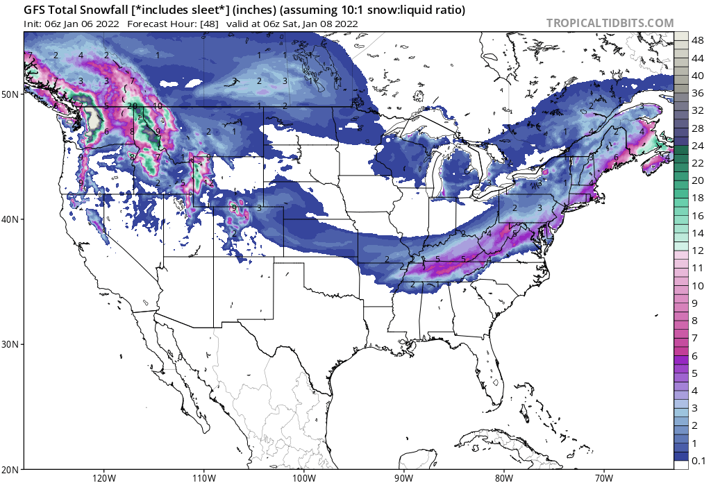
Tracking this little snow band was very difficult and the band of snow did form. The GFS model, the American model, was superior over the European model that always had the KC metro area in at least 1" of snow. The GFS never had KC in it, so if I would have just used only that model, we would have had a nearly perfect forecast. It is rare to see a model do that well. We went with more of a blend, just in case the track would be a bit farther north.
We still did predict that northern edge to be right near KC, and it lined up right over the south side of the city with not even a dusting up north. And, now, the storm is intensifying off to the east. Look at the snow forecast including our little band that tracked just south of KC. This includes the previous 12 hours and tracks it through tomorrow:

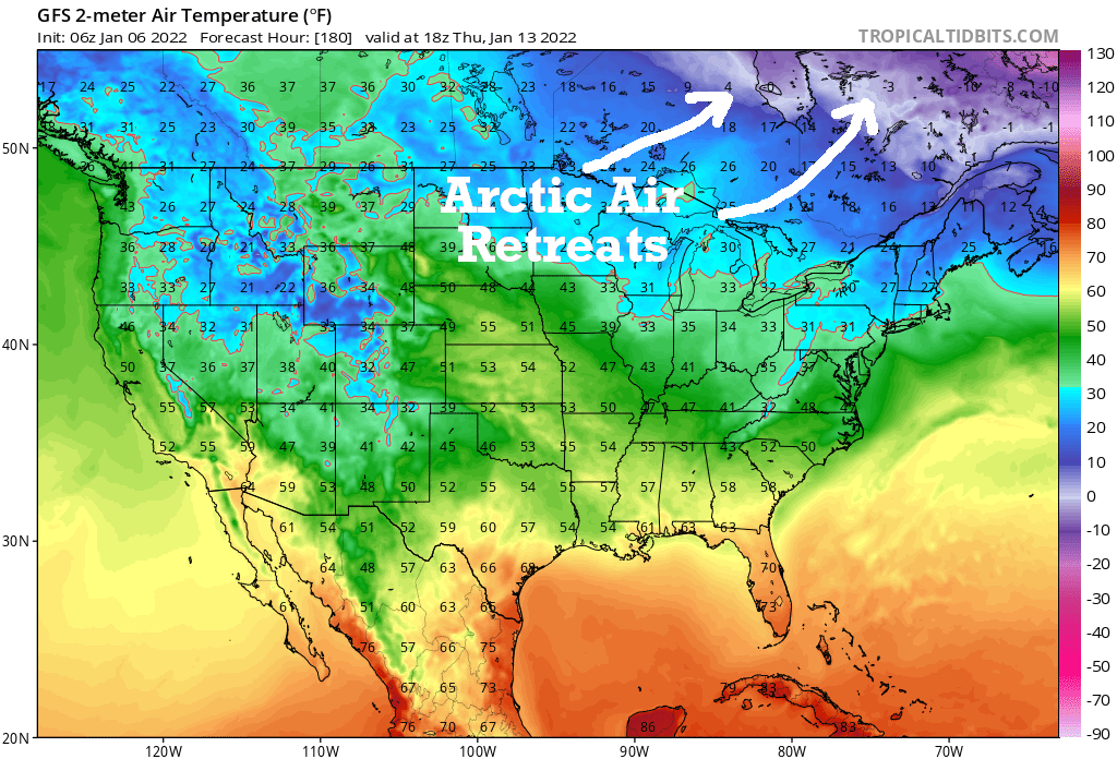
We are in the Arctic air and it has yet to drop below 1 degree this winter season so far. It won't drop below zero again with this system, and look at what happens to the Arctic Air by a week from now:

With the Arctic air retreating, chances of snow will be low. And, we still have not had 1" on the Plaza, so the snowflake contest continues. There are 308 people left out of over 6,000 entries. Someone even picked a July date. That person wins if we don't have 1" of snow, which has never happened in KC history.
This pattern is cycling perfectly according to the LRC, and we are in the second cycle of this year's pattern. The pattern that started out wet in October has dried out, and I do have some drought concerns for the spring and summer. We will discuss a lot more next week as we do a complete analysis of this pattern.
Bundle up and have a great day!
Thank you for spending a few minutes of your day reading the weather blog and sharing in this weather experience. Have a great day.
Gary


