


KANSAS CITY, Mo. — TGIF Bloggers -
While our morning storms have fizzled, the energy associated with this mornings complex looks like it could reorganize a bit by 3 pm. As the energy begins to move into the Kansas City area the environmental could favor some quick developing discrete cells. This isolated/discrete storm nature tends to always have a tornado threat attached to it. That being said, our threat is low overall, but today is a kind of day that if one super cell storms gets going it could become dangerous fast.
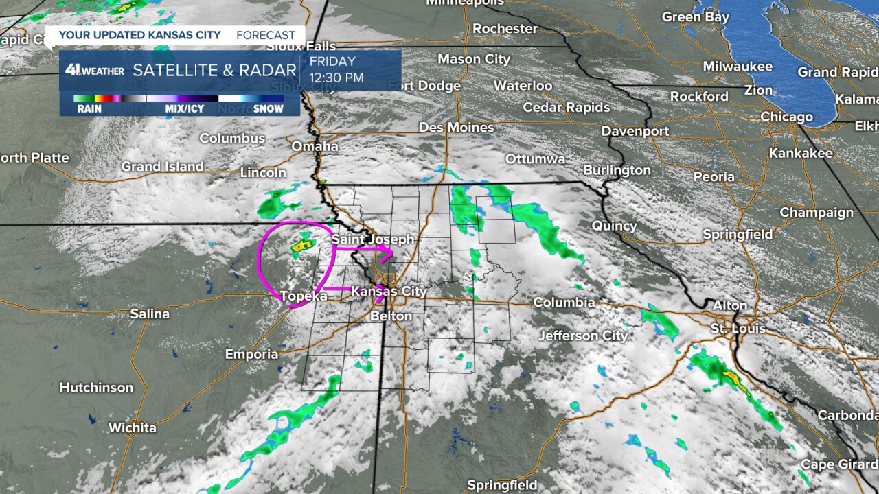
The area where we are watching to storm development is just north of Topeka. As storms begin to fire they will drift east to southeast toward Kansas City.
The timeline we are tracking is between 3-8 pm for severe weather concerns.

The severe weather outlook today has Kansas City in a level 2 out of 5 risk for severe storms to form. The threats are damaging winds near 65 mph, quarter size hail, and a low risk for tornadoes. Expect brief heavy rain and lightning as well with any storms that form.

When it comes to the tornado risk today, here's what you need to know. Areas in green in this map have a 2% chance of a tornado forming within a 25 mile radius and areas in brown are at 5%. I expect the tornado threat to be short lived, think the first 1-2 hours into storm development today. Then storms show signs of becoming more linear in structure which quickly becomes a limiting factor for strong rotation.
That being said, make sure you have a way to receive weather alerts this afternoon and evening.
