KANSAS CITY, Mo. — Good Victory Friday bloggers,
A win is a win! The Chiefs are 5-1 with a very good defense. The offense needs to improve a little bit and the sky's the limit.
Now to the actual sky. We are tracking a cold front that is associated with a storm system in Nebraska. Our area once again landed in a spot that missed most of the rain.
The big rain occurred across Nebraska and Iowa. There were small bands of .25-1" of rain about 100 miles west and 70 miles east and southeast of KC. We will end up with a trace to .10" today.

At least we missed the severe weather that occurred in a small part of central Nebraska. There were a few tornado and 1" hail reports. The icons that have a house on them in northern Nebraska are flooding reports where 3"-6" of rain occurred. The good news is that any location that received rain needed it. There was perhaps a bit too much of a good thing in northern Nebraska.

We will see a lot of weather changes today with the cold front, then we will see steady weather conditions through the weekend.
FRIDAY 6-7 AM:
The cold front was on our doorstep seen on radar as a blue line. We can see the front on radar as a blue line because there are just a few showers along it. If there was a large area of rain and thunderstorms, the blue line would not be seen so well.

FRIDAY 7-9 AM:
The front will move through dropping temperatures from the 60s to 50s. The wind will shift to the west at 10-20 mph. It will stay cloudy as the few showers exit to the east.

FRIDAY 9 AM-1 PM:
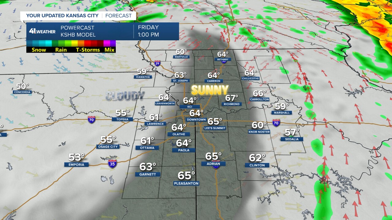
We will get in to the "dry slot" of the storm system. This means the sun will come out allowing temperatures to rise back to the 60s even with the cold front having moved through. The noon sun will be strong enough to overcome the colder air as this is not that strong of a front. The wind will be west at 10-20 mph.

FRIDAY 1-6 PM:
The dry slot will race east to eastern Missouri which means we will become cloudy and windy with temperatures back to the 50s. There may be a sprinkle, but not much more than that. The wind will be west at 15-30 mph making for a blustery Friday evening.

SATURDAY:
Once the clouds arrive again this afternoon, they will be with us all weekend. This is due to the storm system now in Nebraska stalling in the Great Lakes this weekend. As it sits there, small disturbances will track south into our area all weekend around the main storms western side. These disturbances may bring periods of drizzle and a few showers all weekend.
There is a solar eclipse Saturday that runs between 10:25 AM to 1:20 PM. It will peak at 11:50 AM. So, we won't be able to see the eclipse due to the clouds, but it may get a bit darker than usual around noon as the sun will be 60% to 70% covered by the moon around here. Lows will be 45-50 with highs 50-55. A few showers or patches of drizzle may move by as well with a northwest wind at 15-25 mph.

SATURDAY NIGHT-SUNDAY:
Copy and paste Saturday, minus the solar eclipse. It will be mostly cloudy with a north-northwest wind 10-20 mph. Lows will be 45-50 with highs 50-55. A few showers or patches of drizzle may move by as well.
Total weekend rainfall will be a trace to .05". In other words, not much.

STORM POSSIBLE NEXT WEEK:
We will talk more about this over the weekend. A new weather pattern is evolving so we are seeing some new things showing up. Next week we are now seeing a system dropping into the southern Plains from the Pacific Northwest. There is a chance this system could bring some beneficial rain at the end of next week. Confidence is low as we are just now seeing the evolution of the new weather pattern

Have a great weekend
Stay healthy


