KANSAS CITY, Mo. — Good morning bloggers,
We had some freezing drizzle this morning and there are a few slick spots with the crashing temperatures. And, my goodness did the temperatures crash, and they are still in the big drop right now.

It had already fallen from yesterday's high of 69° to 22° as of 7:30 a.m. and it was still dropping.
Freezing Mist: Winter Weather Advisory until noon
Some light freezing drizzle, or light freezing mist produced a light glazing on cars and a few slick spots. Drier air is moving in and this will end the precipitation by later this morning. It is quite light, and there may still be some slick spots out there.
Try to give yourself an extra 15 minutes or so, especially if you have to scrape your windshield this morning. Conditions should improve in a couple hours.
Snow is in Thursday's forecast:
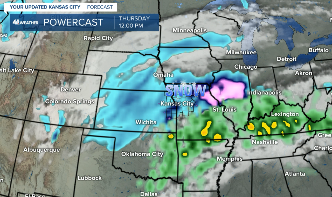
The next storm system is developing over the western United States. I showed last night how just a slight difference could either lead to a snowstorm on Thursday or completely dry. Most of the models have been showing the dry scenario, but not the American model. This model did the best with the last storm so it has our attention.

This map above shows the American Model, or the GFS model forecast of snow at noon Thursday. It is another tricky and difficult forecast for meteorologists and weather forecasters.
All the models have been trending in the direction of the GFS. I am certain we said things like this in last week's blogs. So, here we go again.
Our in-house model at KSHB is showing this snow potential for Thursday. This model had been predicting no snow at all until this latest run, so there is a trend from other models into what the American Model has been showing.

The tilt of the storm and it's importance:
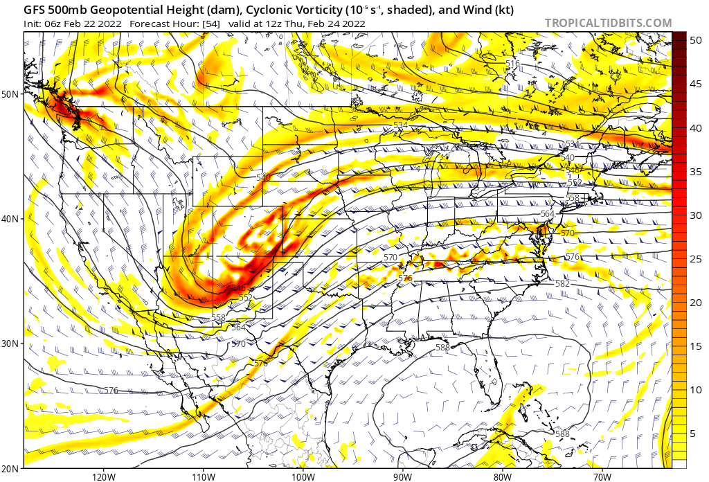
When I am discussing slight, I mean really a very subtle difference in the models. What you need to look at is over Colorado extending south to near the Mexico border. On the GFS model it is just slightly tilted more to the left than the other models. On the second model, if you really look hard and closely you can tell it leans to the right a bit:


That difference is so little and yet so huge. It is so slight, but it makes the difference between a few inches of snow or just a few flakes of snow. Now, if it is slightly more negatively tilted, then an even larger snowfall is possible. This will be something we monitor closely as it approaches. One slight difference on the tilt to the right, and then not much if any snow; and one slight difference the other way, then suddenly we have more significant snow.
Last week I discussed how this storm is the twin sibling to the snowstorm from last Thursday. I didn't say they were identical twins. But, they are so related. We had a similar issue with the last storm. In that one we wondered if the storm would stretch out and weaken too fast and lower snow totals, or would it hold together. We made the accurate prediction of it holding together. As it passed by it stretched out and weakened rapidly. This time we have similar issues, but instead of it having to hold together, we will be wondering if it will strengthen just a little bit.
- Forecast for today: Cloudy and very cold. Wind chills from 5 to 15 degrees. It will be cloudy with the freezing drizzle ending. Temperatures dropping into the upper teens to lower 20s and staying steady from there.
- Wednesday: Partly cloudy. Low: 5 to 8 degrees. High: 24°
- Thursday: Cloudy with a 70% chance of snow. Accumulations possible. High: 23°
Thank you for spending a few minutes of your day reading the weather blog and sharing in this experience. Have a great Tuesday.
Gary


