Good Monday, bloggers —
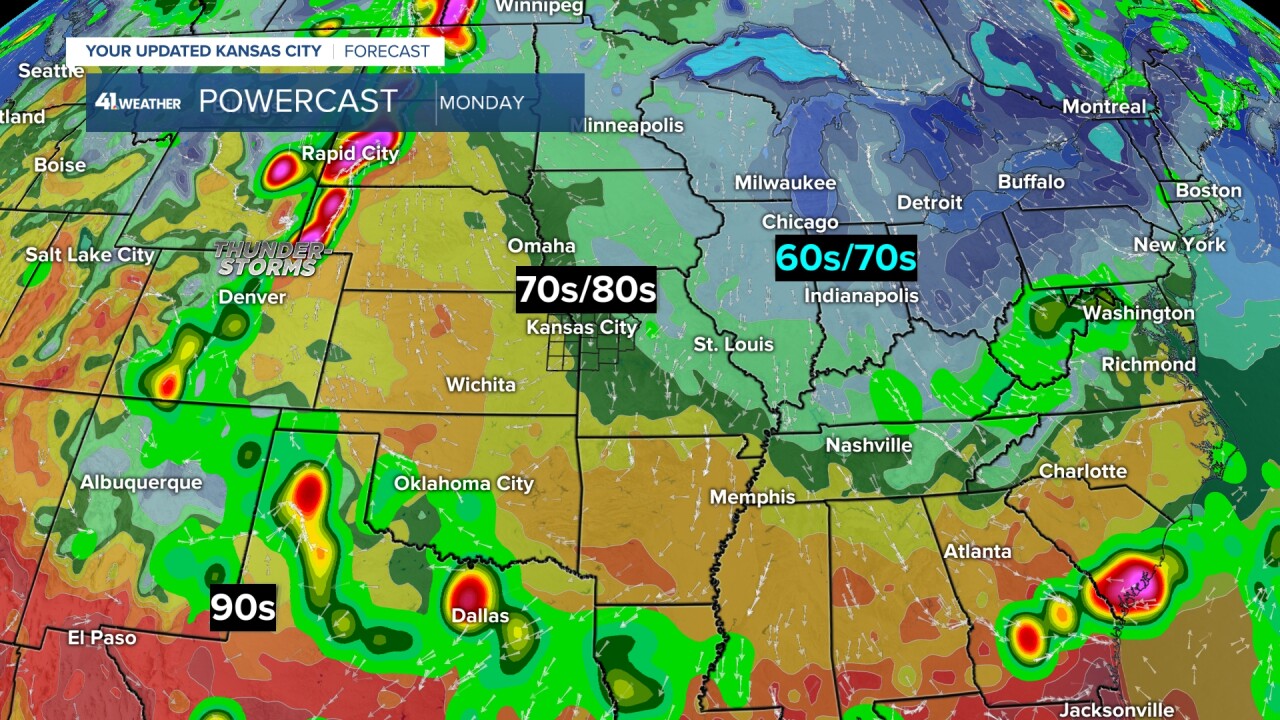
We are starting the week with great June weather. A warming trend begins on Tuesday and it ends on Thursday.
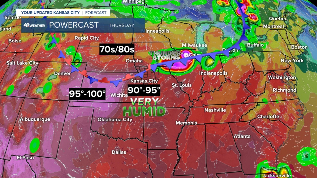
By Thursday, it is looking like our hottest day of the season so far and our hottest day since Oct. 2, 2023.
What is special about Oct. 2, 2023? It is the last time we reached 90° officially.
Now, June 7 was 92° downtown, but the Kansas City International Airport, the official recording station for Kansas City, reached 89°.
Let's go through the next 7 days as we track the heat and the chance of thunderstorms.
MONDAY:
We are in for great June weather with highs around 80° and low humidity with a light north breeze at 5-15 mph.

TUESDAY:
It will be another nice day as temperatures warm to the mid-80s and the humidity increases a bit with a south breeze at 10-15 mph.
Systems will bring thunderstorms to the southern Plains and upper Midwest. We are in between the two systems, which means we will see some clouds and perhaps a sprinkle, but we are leaving the forecast dry.

WEDNESDAY:
The wind will pick up from the south to 10-20 mph, which will bring in warmer air and more humidity.
Our high could easily reach 90° for the first time since Oct. 2, 2023.

THURSDAY:
If we don't reach 90° Wednesday, we will on Thursday.
There will be a south breeze at 15-25 mph to help, but the humidity is likely to get out of control as the dew point may rise to the mid and upper-70s. This could make the heat index reach 100°-110°.
This heat and humidity will make it much easier for thunderstorms to form on a front that will be drifting our way.

Here are some stats on the 90s in KC.
We have not reached 90° since Oct. 2, 2023, which was 252 days ago. Our latest recorded 90° was on July 15 way back in 1904.

FRIDAY:
The front gets in here Friday, and this is the day when we have the best chance of thunderstorms. It will not be an all-day rain, but we are not sure at this time what part of the day the thunderstorms are most likely.
We could see them later Thursday night into Friday morning and/or Friday evening into early Saturday.
The flow aloft will not be that strong, so the severe threat is low, but a few thunderstorms could have strong winds.
The main threat in the thunderstorm zone will be flash flooding. It is far too early to know where the main thunderstorm zone will set up.
Friday will be a warm and humid day, but clouds should keep us below 90°.

SATURDAY:
The front will lift north as we track a system tracking northeast out of the Rockies.
The system will produce some big thunderstorms from western Kansas to central Nebraska. We may see some morning thunderstorms with the retreating front.
The front that arrived Friday will become a warm front and head north. Our highs will be in the 80s to near 90°.

SUNDAY MORNING:
The new data takes the thunderstorms to our west and races them to the northeast, leaving us with a few showers and thunderstorms during the morning.
Since our humidity will be high, the thunderstorms will have a better chance of making it in.

SUNDAY AFTERNOON:
Regardless of whether we see thunderstorms Sunday morning, it will become breezy, hot and very humid by afternoon as there is no cold front associated with the system.
Notice the south winds everywhere. Our highs will likely reach 90° Sunday, which begins a stretch of 3-5 days where we will see highs in the 90s.

It takes around 1"-2" of rain to keep the yard green this time of year as the high sun angle and higher temperatures can dry the top soil out fast.
Fortunately, we finally got hit by rain over the weekend as it was around KC — that was getting missed the last 6 weeks.
The last 10 days, we have seen 2"-3" of rain while there has been way too much rain from Emporia to the Ozarks, where there was flooding over the weekend.
Northern Missouri has not seen much rain, but they saw some decent rain prior to this 10-day period.
Note, your rain gauge may read differently as these are radar-estimated totals.

The next 7-10 days will see the heaviest rain across Oklahoma, Texas, Minnesota and Wisconsin.
Our area will see a few bands of 1"-2" or more depending on how the thunderstorms set up Thursday night into the weekend.

Now, since we have seen rain, the grass is growing fast. The best days to mow will be today and tomorrow.
It will become too hot and humid Wednesday and Thursday unless you mow early in the morning or the evening.

Have a great week.
Stay healthy.
—


