Good Friday bloggers,
We have some great pool weather heading into the Labor Day weekend. We will not see clouds until Labor Day, and it has been so clear we got a clear picture of Venus in the eastern sky this morning.
We may be heating up this weekend, but it will be 10 times colder here than on Venus. Hint: Venus is around 900°.

Before we look ahead we look back as it is August statistics day. The numbers below are from Kansas City International Airport, the official reporting station for Kansas City.
We had a nearly 50° spread in temperature as we reached 103° on the 25th and 57° on the 16th. August 19-25 we had the longest heat wave since 2012. There were 7 consecutive days where highs reached 95° or higher. Heat index values reached 120°-135° as the humidity was out of control.
Officially, at KCI, it has been dry since August 14th which is a 19 day dry spell. Some locations saw around .25" of rain on the 26th. 1-4" of rain occurred on the 26th across northern Missouri.

Now, let's go through this forecast. When is the next chance of rain?
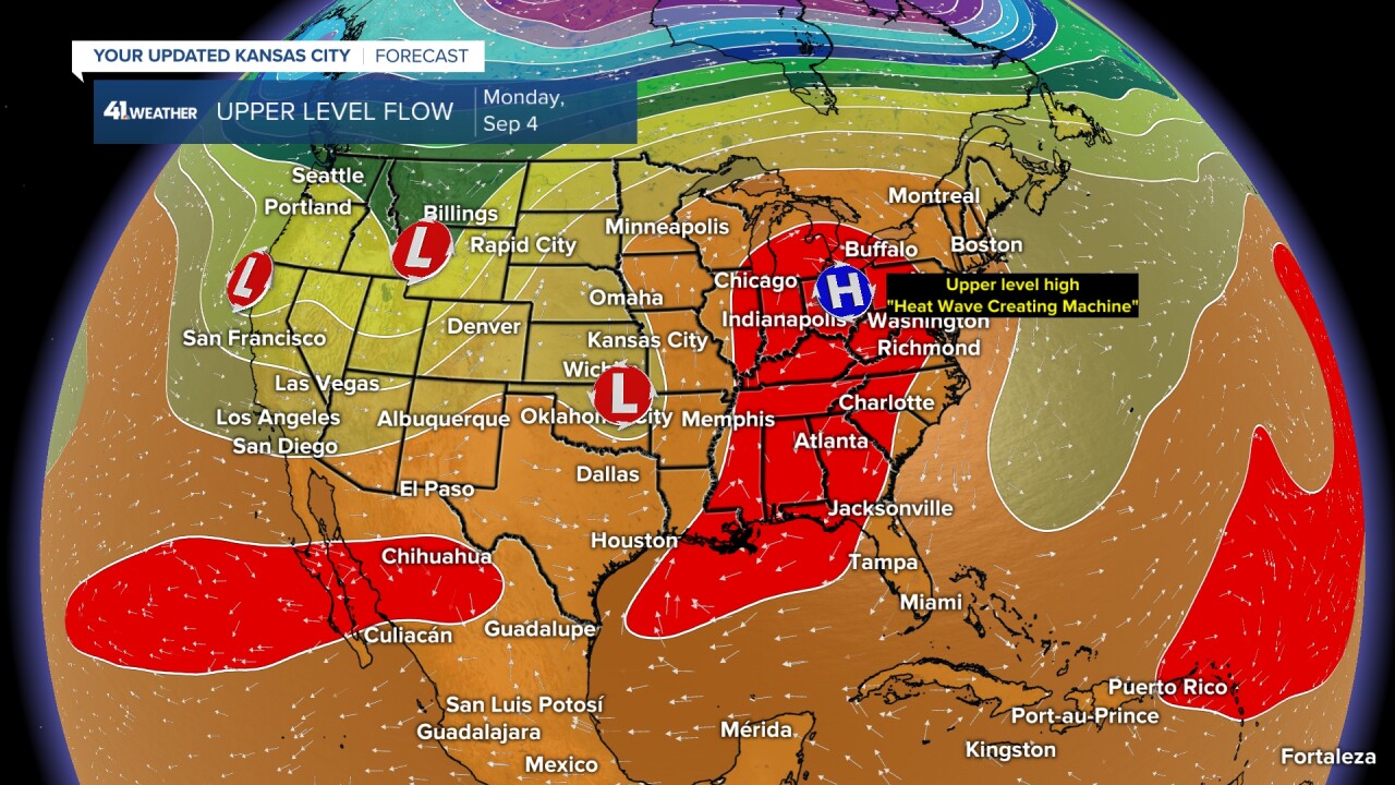
When we look at the upper level flow, there is no chance of rain when we have a new upper level high, "heat wave creating machine" over head.
UPPER LEVEL FLOW:
TODAY: The upper level high is building over the middle of the USA as we also track a small upper level low over Louisiana. The upper level low is the opposite of an upper level high.

SATURDAY:
The upper level high increases and peaks in strength over us. The good news is that this is not going to be as strong, big or long lasting as the one in August. Also, the humidity will not get out of control.
The little upper level low moves in to southeast Texas.

LABOR DAY:
The upper level high gets pushed to the east as the low heads north. This will bring more clouds, so our temperatures may drop a bit, but the humidity will be higher. This system may bring a few showers and thunderstorms to the region. We will talk about that next.

WEATHER AROUND THE REGION:
TODAY:
It will still be comfortable with highs in the 80s and low humidity under 100% sunshine. Wind: S-SE 5-15 mph.

SATURDAY:
It will warm in to the low 90s under 100% sunshine and a south-southwest breeze at 10-15 mph. The humidity will stay in check.

SUNDAY:
It will warm in to the mid 90s under 100% sunshine with a south-southwest breeze at 10-20 mph. The humidity will stay in check. Highs will reach 100°-105° in the western Plains.

LABOR DAY:
We will see highs in the low to mid 90s as the humidity increases along with a south breeze at 10-25 mph. We will see more clouds as well as the small system from the south tracks into the region. We are leaving the forecast dry for now, but scattered showers and thunderstorms are possible in southern Missouri. Highs will be in the 80s in rain areas. Keep this in mind if you are headed to the Ozarks, Table Rock and any other locations in southern Missouri.

THE NEXT RAIN CHANCES:
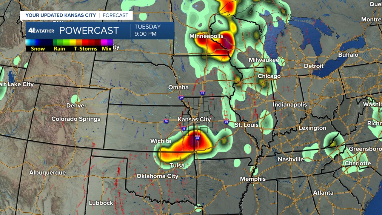
Assuming we do not see rain Labor Day, the next better chance will be Tuesday evening and night along a weak cold front. It may set up south of our area, but it is far from being set.

If the rain chance misses Tuesday, there will be another chance Wednesday as a front stalls in the area. These thunderstorm chances will be the start of a more active weather pattern that may last 7-10 days. Right now it looks dry for the Chiefs season opener next Thursday that is televised on KSHB 41.
We will have more on this weather change this weekend.

If you are headed to Lawrence today for the KU game or Manhattan Saturday for the K-State game it will be hot and dry. The humidity will be low and at least the games are in the evening as temperatures cool.


Have a safe Labor Day weekend.
There is a Drunk/Texting while driving warning in affect for all of those who have been injured or killed in drunk/texting while driving accidents. This is in memory of Nathan Mcduffie that lost his life in a drunk driving accident around 35 years ago.
Please do NOT drink/text while driving.


