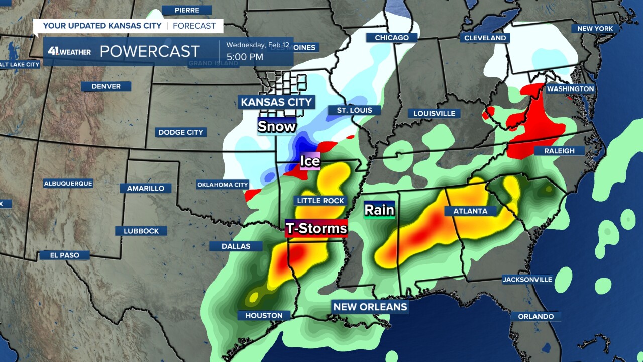
KANSAS CITY, Mo. — Good Wednesday bloggers,
Hope you were safe this morning. We discussed how the temperature was going to be critical in determining how icy it would become. We also said decks, bridges and overpasses would be the first surfaces to get icy. The temperature dropped to 27-29, so it was plenty cold when the drizzle started. So, it was freezing drizzle. And the bridges and overpasses became skating rinks while other paved surfaces had some slick spots.
Why did the elevated surfaces become so slick? And, we had a good question from a viewer.
"Why did it seem like the roads were worse today compared to storms from a month ago?"
First, the elevated surface answer, then the answer to the viewer question.
The precipitation type is the No. 1 reason. We had freezing drizzle, just a lighter form for freezing rain. A month ago before the blizzard, we had heavier freezing rain.
Freezing rain/drizzle is liquid water that freezes on contact with below-freezing surfaces. It glazes and clings to everything. It can create skating rink conditions. If there is enough freezing rain and the ice gets to 1/2" or more, then trees and power lines can come down. That is a full-blown ice storm.
The precipitation starts as snow in the cloud, then the flake encounters a layer above 32° and it melts to a raindrop. It falls to the ground staying a raindrop because it does not have enough time to freeze again as the above 32° layer is so thick.
Sleet starts as a snowflake, melts to a raindrop, but refreezes to a frozen raindrop before reaching the ground as the above 32° layer is less deep, so the raindrop has time to freeze before reaching the ground. This is more desirable as the sleet or ice pellet bounces when hitting the ground and does not cling to trees and power lines and you can get some traction on roads.

This morning we had freezing drizzle which is zillions of tiny water drops. This forms in low clouds as water and stays water until encountering a below 32° degree surface. The drops are so small they stay as "supercooled water" in below-freezing air. A supercooled water explanation is for another time. LOL. Freezing rain or freezing drizzle can cause skating rink conditions.
So, why the decks, bridges and overpasses? These surfaces are surrounded by the outdoor air. So, when the air temperature drops from 35 to 27 like the last 24 hours, they cool off much faster, assuming the air temperatures. Roads and other surfaces not surrounded by air retain heat, so there is a lag before they would drop below freezing.

This is what happened this morning as most accidents occurred on bridges and overpasses. Decks were icy and some other non-elevated surfaces were starting to get slick spots, but then temperatures started to rise. This was a picture taken in our studio by meteorologist Lindsey Anderson. This was a big accident on an overpass. We do not think there was any treatment on the bridges. That would have helped immensely.

Now, this leads to the viewer question. "Why did it seem like the roads were worse today compared to storms from a month ago?"
There are actually two answers. We have seen two situations this winter where we have had icy conditions. Those were today and before the blizzard on Jan. 4-5.
The first answer is after the freezing rain before the blizzard we had a change to sleet and snow. So, they covered the ice giving traction.
The second answer is that it was actually much worse before the blizzard. The entire city turned into a skating rink before the changeover. This was taken in south Overland Park on the night of the 4th. Yikes!

There was pre-treatment on the roads, but the rain washed it off and temperatures were in the mid-20s. So, the answer is it wasn't as bad and it was much worse depending on when you experienced the January storm outside.
————————————————————————————————————————————————————
Now, what is next? We are going in to a more active weather pattern.
Details are in the five minute video below.
Have a great rest of your week and weekend.
Stay healthy
GO CHIEFS!


