KANSAS CITY, Mo. — Good Monday bloggers,
Well, another week is here and it's another week where we still need rain.
Drought conditions are widespread in the middle of the USA, centered around Interstate 35. The northwest corner of Missouri and a few locations in northern Kansas City are not in drought. But, that is rapidly changing.

There is a small system near Salt lake City Monday afternoon. It will track into the Plains Tuesday and cross our region Wednesday. It is small, but potent. There will be very heavy rain near its track.

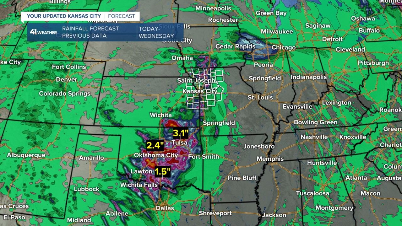
Here is a previous run of rainfall forecast data for Tuesday-Wednesday that had some decent rain along the I-35 corridor from Texas to southwest Iowa. Oklahoma into Texas get 1"-4" of rain.

When we zoom in to our region there is a widespread .25"-1" rainfall that occurs mostly Tuesday night into Wednesday. A few showers and thunderstorms are possible during the day. We need much more than .25"-1", but it is better than nothing.

Here is the current run of rainfall forecast data for Tuesday-Wednesday as of noon Monday.
Uh oh! The heaviest rain is still in Oklahoma and Texas (2"-5" of rain), but we are in almost nothing. This solution does not have a northern piece of energy coming north to bring us the consolation prize of rain.

When we zoom in to our region, amounts are piddly, trace-.10".

Which one is right? We are leaning with the drier solution as that is what has been going on. But, this is not set yet.
If we miss the rain Tuesday-Wednesday, there is another chance Friday and/or Saturday. It could be as soon as Thursday night. This would be from a cold front that would bring widespread .25"-1", to possibly 1"-2". There is some data trending to having most of this east of our area. But, we lean with this solution for now.
Regardless, of what day we see the rain, it should be out of here by Chiefs Sunday.

Have a great week ahead.
Stay healthy.


