

KANSAS CITY, Mo. — Good Saturday bloggers,
Ida is now a rapidly intensifying hurricane as it tracks northwest across the very warm water of the Gulf of Mexico. It is headed to Louisiana tomorrow and Monday.

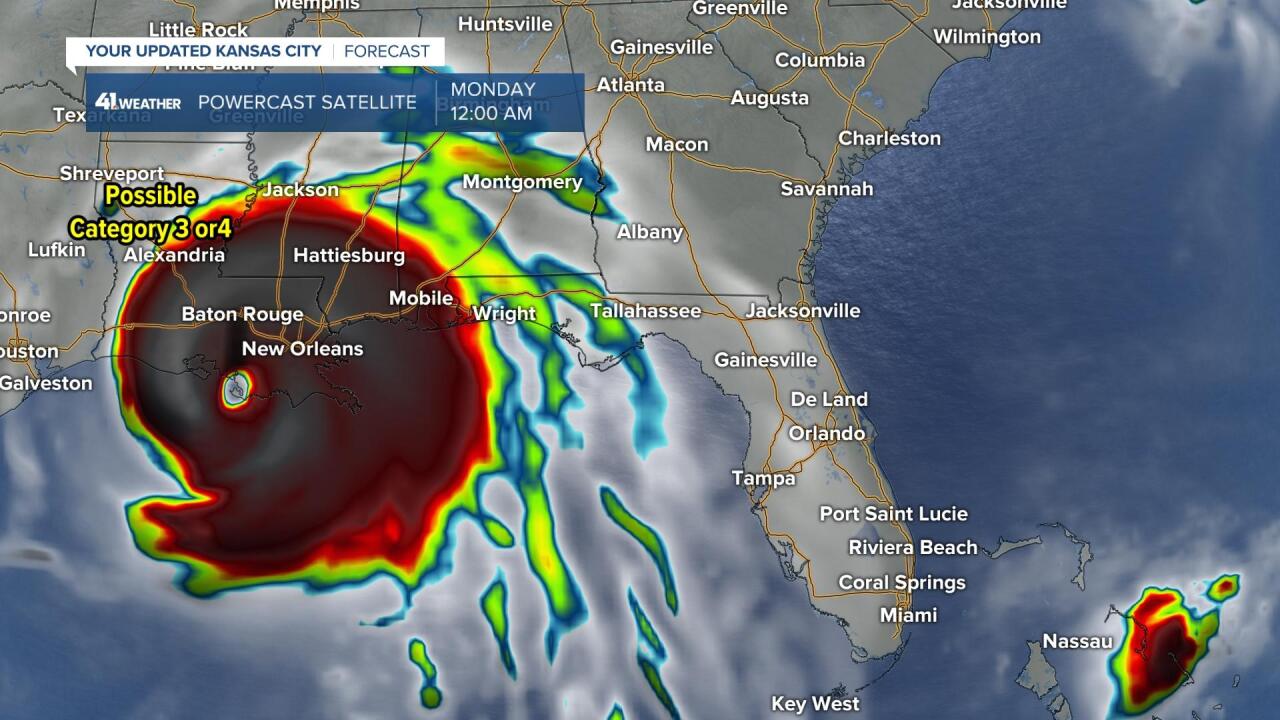
This is what our Powercast computer model is forecasting the satellite of Ida to look like Sunday night at midnight.
This would be a problem. It shows a very powerful hurricane with a well defined eye on the Louisiana coast. It shows New Orleans in the very dangerous northeast quadrant of the hurricane. More on this in the video below.
Also, we are still in need of a cold front. We have been talking about a cold front for days. A cold front is still in the forecast.
Details on Ida and the cold front are in the 5 minute and 45 second video below.
Have a great weekend and stay healthy.
