KANSAS CITY, Mo. — Good Wednesday bloggers,
We have been in one odd weather pattern this summer. A tropical storm hits southern California, extreme humidity, the longest heat wave in 11 years for KC in a relatively cool summer, more severe weather in July than May and June, and now the remnants of Harold to help end the heat.
First, if you think this has been a hot summer, it can always be worse. As a matter of fact this is the 79th warmest summer out of 135 years with an average temperature of 76.6°.
It is the coolest summer since 2019. The hottest summer ever recorded was in 1934 during the "Dust Bowl", with an average temperature of 84.9°. We had 46 days 100° or higher that year.

The story of summer 2023, which is an odd one, is not over as our heat wave ends this weekend. This will make it a seven-day heat wave, the longest in 11 years.
The length of the heat wave is odd in the fact that this is not a hot summer. The last heat wave this long was in 2012 which was the 13th-hottest summer on record.
Also, we are almost done with day five of the heat and we have not hit 100° officially. This will likely change by day six or seven. We do not see any sustained high heat after this, but that does not rule out some hot days.
Next, let's talk about the rest of this heat wave and the peculiar way it will end.
TODAY:
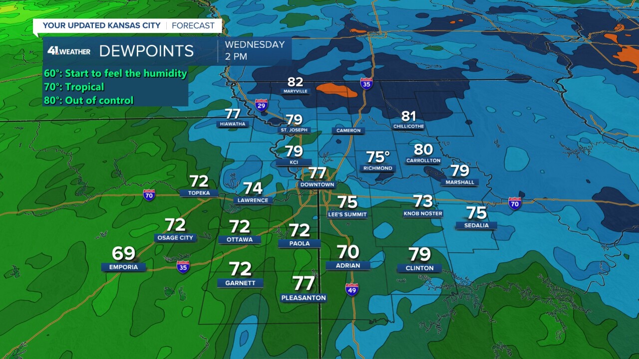
As of 2 p.m., we will be officially at 94°. We will easily reach 95° to keep the heat wave going. But, we may wind up a degrees short of 100° as we are still having extreme humidity. The winds are from the southwest and this is bringing in slightly drier air.

This less humid air where dewpoints are closer to 70° rather than 80 should get here by Thursday.

THURSDAY:
It looks like we will be around 100° on Thursday with moderate to high humidity. This will keep heat index values in the 115°-125° category.

FRIDAY:
There has been a strong trend of the cold front not arriving until night. This means we have the chance to hit 100° again. We are now going 100°, but could still be in the upper 90s depending on the fronts timing and any extreme humidity.

CHIEFS SATURDAY:
There is good news and bad news concerning the heat. The good news is that we will be behind the cold front, receiving a northeast breeze. This should drop our high to 85°-90°. The bad news is that we may end up in a zone of high dewpoints behind the front. So, it may still be rather uncomfortable.
There may be scattered thunderstorms as well. Right now the chance is 30%.

SUNDAY:
Rain and thunderstorms are looking more likely with time. Where it is raining it will be in the 60s and 70s! In locations where it is not raining it will be around 80°. In locations where it rains during the morning and then ends, highs will reach 75-80. Vice versa, if it does not start raining until afternoon the high may reach 75-80 before dropping to the upper 60s and low 70s.
We may see around 1" of rain or more in many locations.
Now, here is the odd part. The rain is being caused by the remnants of Tropical storm Harold that hit the south Texas coast on Tuesday.

TROPICAL STORM HAROLD:
Harold made landfall Tuesday and is now entering southern Arizona as it tracks around our large upper level high, heat wave creating machine. Harold will continue to track around the upper level high, but the upper level high will be retreating to the southwest and shrinking the next 5 days. This pivots Harold right into eastern Kansas Sunday.

Thursday night Harold will be at four corners in the southwest USA.

Friday night at midnight Harold will be in northeast Colorado.

Saturday night Harold is tracking into southern Nebraska.

On Sunday Harold will likely arrive with rain and thunderstorms.

So, having heat end from a tropical system remnant is not out of the question when it makes landfall in south Texas. Here is what is unusual.
When we get the remnants of a tropical system, they most likely make landfall in south Texas. Except, Harold heads to Arizona then Colorado before it reaches KC. And this is very unusual if not the first time ever. We really could not find any tropical system to take this track. There were a couple of unnamed systems in the 1920s that tracked into the southwest USA from the Gulf of Mexico.
The odd summer continues.

Have a great rest of your week and weekend.
Stay healthy.


