


Happy Thursday Bloggers -
In the next few days we've got two rounds of severe storms to get through. The first time period of concern is Friday night and the second is Sunday night. There will be some morning rain and thunder both Friday and Sunday as well, but those chances should stay below the severe threshold.
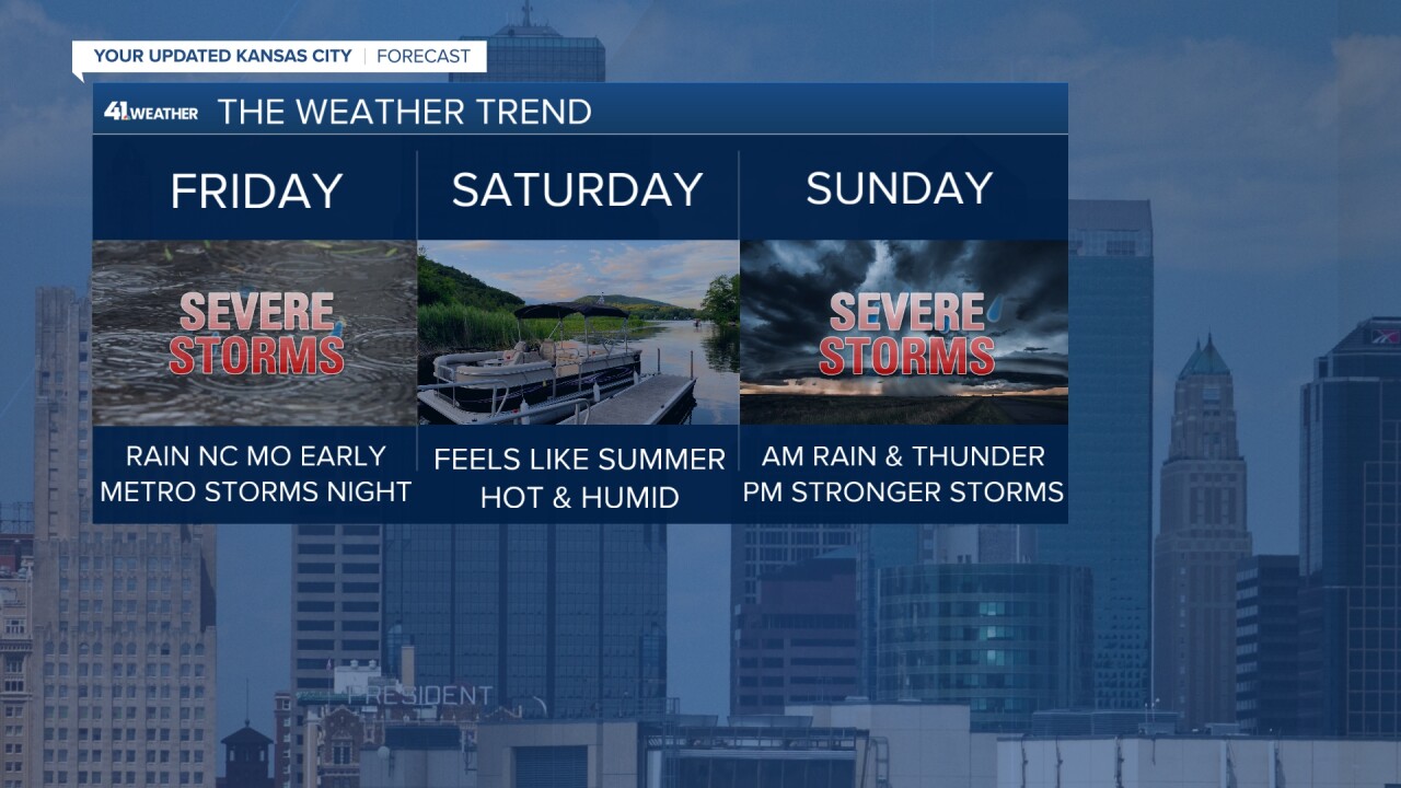
We are tracking a cold front that will sweep through the northern Midwest to interact with a surface system in Oklahoma and bring two rounds of rain chances to Kansas City Friday.

Friday Morning
Friday morning there is a chance to see some rain and thunder on the trailing end of the cold front through northern Missouri (think Trenton-Chillicothe north). This should stay low end of the spectrum. I know northern Missouri has been handed heavy rain event after heavy rain event lately, so when it comes to flooding potential, know that this isn't quite the set up for that. Rain totals are looking to stay under 0.5'' and everything should be fairly isolated.
Friday Midday
Get set to sweat! Our humidity will be on the rise and the heat index will be back near 100° on Friday ahead of this front. Overall the day swill be soupy but mainly sunny as we wait for storms to form by the evening hours.

Friday Night
Friday night looks to be our next window for severe weather. We are watching for wind, hail and flooding threats with this set up, the tornado risk remains very low.

Storms look likely to start up by 5-6 pm and last through 9-10 pm. Right now, the boundary looks to stall a bit right over KC, which means storms could threaten the metro core Friday night. Now, where this boundary stalls is still a little questionable so make sure you are staying up to date on our evening storm potential.

Depending on how this stationary boundary behaves through the evening, don't be shocked if rain chances linger a bit for those south of I-70 into early Saturday. Whenever we see a stationary boundary, flooding concerns come to mind and that will be something to watch alongside wind and hail threats with Friday night storms.
This Weekend
Right now, Saturday is looking to stay dry during the day but it will be fairly hot & humid. It's Sunday that we are keeping a closer eye on.
This weekend is shaping up to feel like summer we've got heat, humidity and storms all trending. Saturday will be hot and humid ahead of another round of severe storms eying to impact your Sunday plans. @KSHB41 pic.twitter.com/832ywN0Fo9
— ☀️ Cassie Wilson (@CassieKSHB) August 10, 2023
Right now we are watching two waves of rain and thunder. The first looks to be along a warm front through the morning. This could lead to scattered storm activity, but this isn't really the severe window.
Sunday night looks to be when the cold front passes through and right now that is looking to be around or after sunset. This system is still very much evolving so stay tuned for updates. While all modes of severe weather on on the table Sunday, keep in mind this system is leaning to be more as a wind and flooding threat. Behind this front though, cooler and drier air will settle into the area. And after a couple very humid day Friday-Sunday, Monday will feel great!
Expect to start the work week with more of a Fall like feel.
Stay tuned for weekend updates when it comes to severe weather and make sure to have a way to stay weather aware for Friday!
—
