Good Friday bloggers,
We are entering a rather interesting and odd weather pattern as the upper level flow blocks up.
This is the upper level flow for Tuesday. There is a big upper level low in Nebraska, another in New England and a third off the Oregon coast. In southern Canada we have upper level highs and ridges. This is a classic blocked pattern as the upper level flow looks like a jigsaw puzzle.
What does this mean?
Storm systems will start to move rather slow. So, the big storm in Nebraska will arrive Monday-Tuesday and not exit until Friday. Actually, it will weaken in place.

We are tracking the big storm next week, but a smaller one will track across the region tonight.
Heavy rain and a few thunderstorms will cross Oklahoma, Arkansas, southeast Kansas and southern Missouri between midnight tonight and noon Saturday. 1"-2" of rain is likely down there. A few showers/drizzle may sneak north into KC midnight tonight to 9 AM Saturday. North of KC there is almost no chance to see any rain, perhaps some mist.

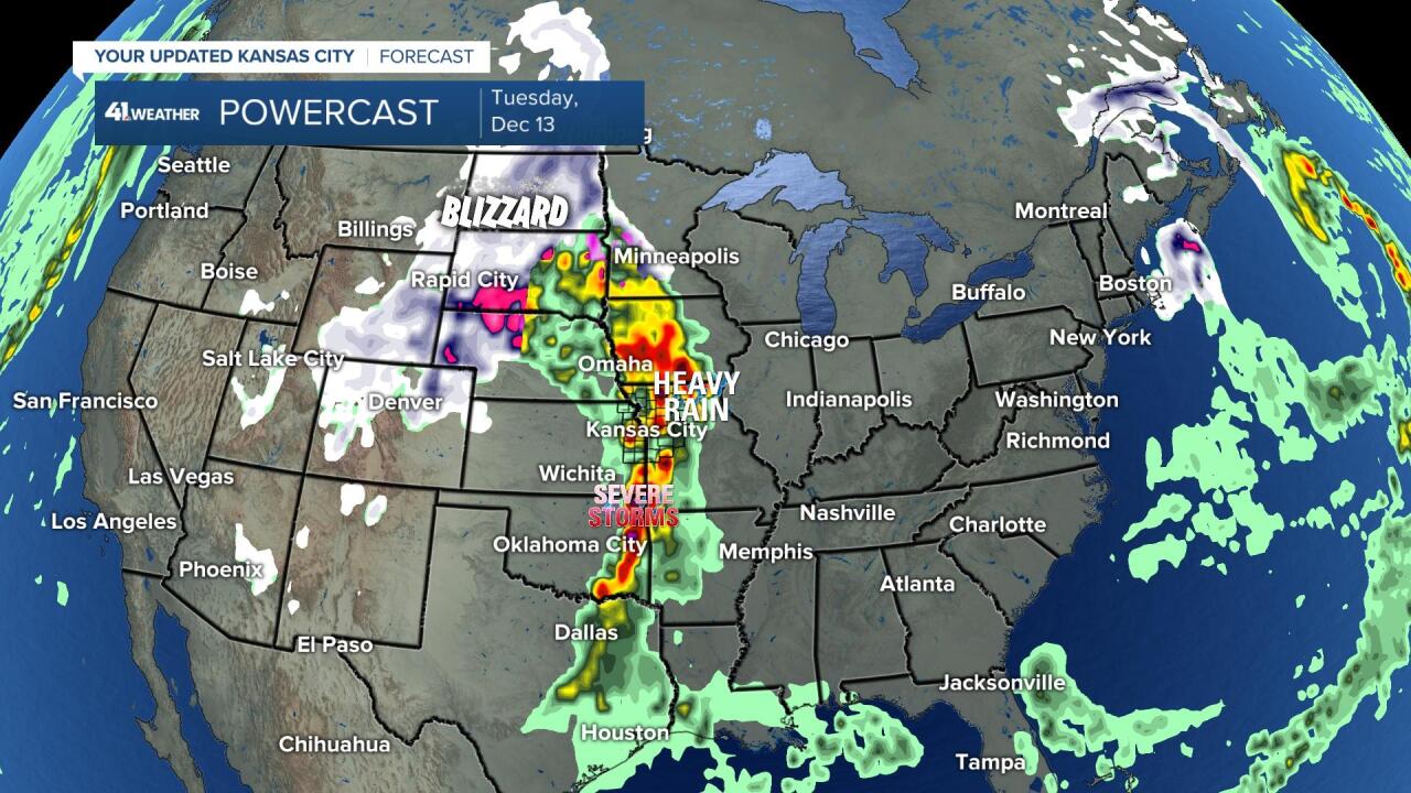
The big storm will reach its peak strength Tuesday-Wednesday. A blizzard is likely across the northern Plains with severe weather possible in the southern Plains. KC is in the middle and we have a decent chance to see 12 hours of rain, heavy a times, and a few thunderstorms Tuesday. It will be too cool around here for severe weather.
After the band of rain will see much colder air move in and may see a few snow showers Thursday-Friday.
The wind will be gusty with this storm as well.

Look at the potential snow amounts with this large storm. The Dakotas may see 6"-14"+ of snow with 30-50 mph winds. This is also known as a blizzard.

This storm most likely will not bring any accumulation to KC, but there will be 1-2 chances of snow before Christmas. This makes our chance of a "White Christmas" 30-40% which is above average.
We will have more on this wild weather pattern over the weekend.
Have a great weekend and stay healthy.


