Hey Bloggers,
Wes here with a Monday evening update.
Showers and storms are expected to move in after midnight and last through much of Tuesday morning. A break from the rain is expected around midday before more storms develop as cold air begins to move closer to us. Both rounds of rain may come with strong storms capable of damaging wind gusts and small hail.
Tuesday evening the rain restarts and as cold air comes in, changes to snow around 9pm, as the wind begins to howl.
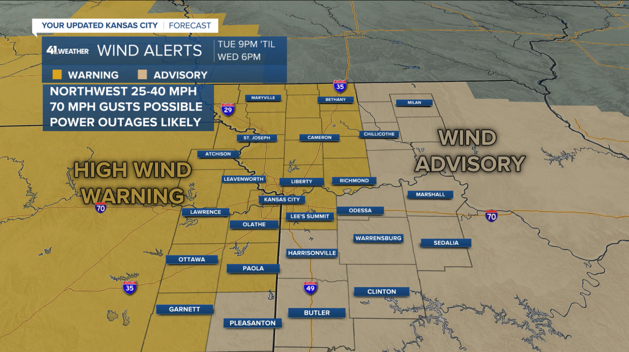
The Kansas City metro is under a high wind warning from 9pm Tuesday until 6pm Wednesday as the wind will blow sustained 20-40mph, gusting up to 70mph. The windiest period will be Tuesday night-Wednesday morning as the rain transitions to snow.

This mean visibility will be reduced from blowing snow, possibly down to a 0.25 mile or less in northwestern MO and northeastern KS where a blizzard warning is in effect.

The wind will lead to power outages, possibility widespread near and north of I-70.
Snowfall amounts for the whole area look to be generally a dusting to 2" but amounts near 3" are possible in those corners of Kansas and Missouri. Even if snow amounts end up being low, 1" or less, moisture on roads may freeze Wednesday morning as temperatures fall below freezing. If it gets into the 20s, any road not pre-treated may become icy, not just elevated roads.

The cold air and wind will lead to wind chill values of 10-15° Wednesday but temperatures are expected to warm above freezing in the afternoon so most of the road impacts will be in the morning.
Monitor my social media pages for more updates
PREVIOUS POST
Good Monday bloggers,
We are tracking a very strong storm system for Tuesday and Wednesday. This storm will bring a tornado outbreak to the southern United States and blizzard conditions across Nebraska and northwest Kansas. But, here in Kansas City, we may see near-blizzard conditions after rain and thunderstorms.
The rain and thunderstorms will move in to our area after 3 a.m. Tuesday.

The rain will change to snow Tuesday night in our area with wind gusts 50-60 mph. These are severe gusts without thunderstorms.
Here is a summary of the incredible amount of weather changes we will see Tuesday and Wednesday.

Details on this "March weather madness" are in the video below.
Have a great week
Stay healthy
Stay with KSHB 41 and we'll keep you advised.


