


Happy Friday Eve #41Weather Readers-
Tonight there is a weak ripple that will pulse up some storms in central Kansas. While that will bring some rain and thunder to the area it's really Saturday that we are focusing in on.
This weekend we are kicking off Fall, but it's going to be a split weekend. Saturday will feel more Summer like with warm weather, some wind and even strong-severe storms. But Sunday, it will feel like Fall for the Chiefs game, and should be dry!
During the Fall we have a "secondary" severe weather season. It is nothing compared to the Spring but there is a small increase in storm potential and our climatology when it comes to tornado count.

So Saturdays front is interesting because it is kicking off the Fall and kicking off our "secondary" severe weather season also. So let's talk rain.
First we have to tackle a weak ripple that is possible tonight. Expect this system to move in by 8-10 pm and last through 1-2 am. Showers and storms should stay scattered and rain totals closer to 0.25'' but some areas south could see maybe 0.5''.
When it comes to Saturday, we've been tracking the chance for severe weather for a few days now and the timing is starting to come together a bit better to impact your Saturday between 4pm/6 pm through 10pm/12am.
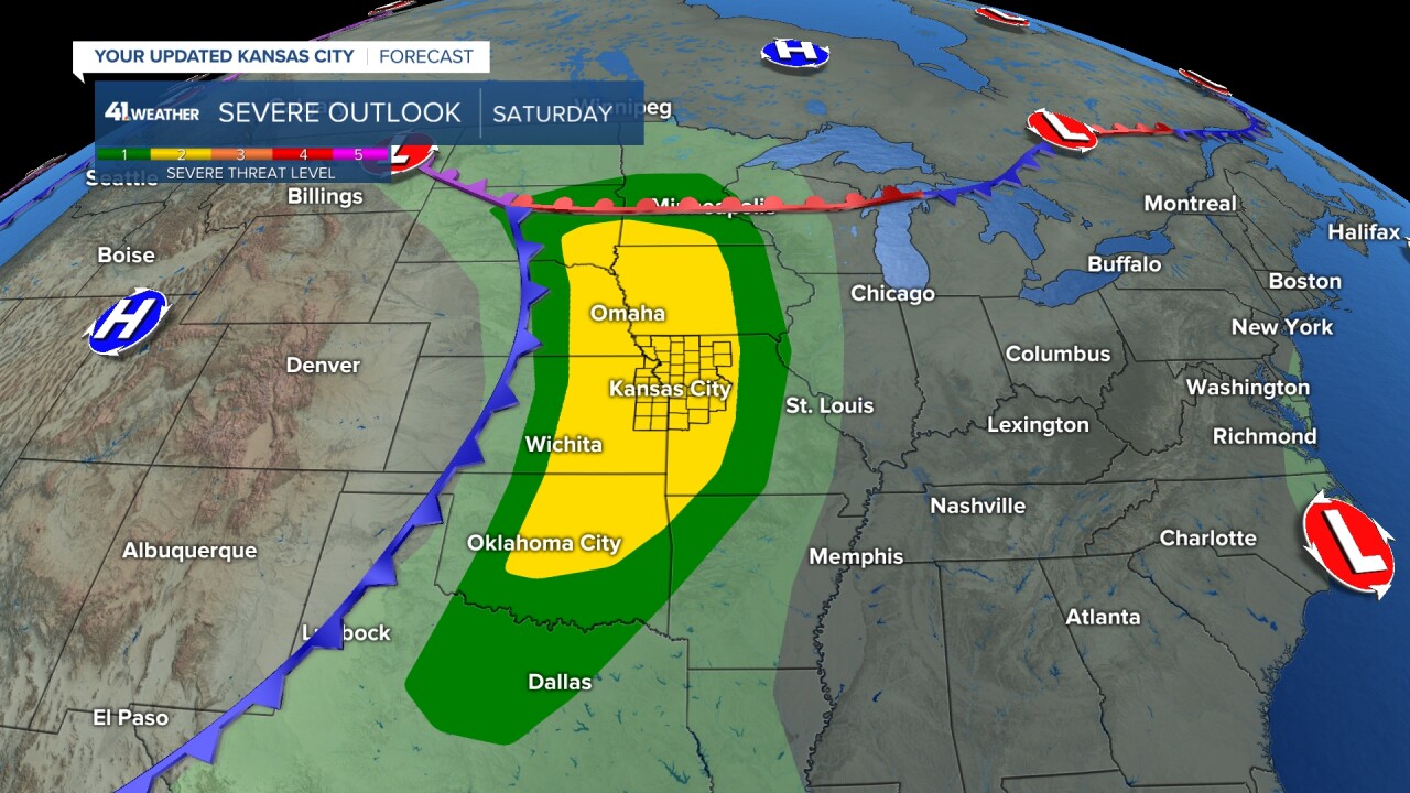

We should feel the impact from the warm front first with a boost in heat and some added wind for your Saturday. This system will be starting to occlude in the northern Great Plains but will drive a secondary low to develop at the surface.
This secondary low will help bring the cold front through Kansas City Saturday night and draw storms from Nebraska south through the day. We will see the potential for some super-cell storms to develop ahead of the cold front Saturday afternoon mainly into northern Missouri.
As the storms move south they should turn more linear as they impact Kansas City. While all modes of severe weather are possible at this point in the forecast, wind is the primary concern on my mind. For now expect a stormy Saturday evening and stay tuned for updates as we are kicking off our "secondary" severe weather season.
—
