


Good Tuesday bloggers,
There are thunderstorm chances every two-three days as we remain in an active August weather pattern. Each thunderstorm chance is unique. Wednesday is one of our thunderstorm days. This is looking like a widespread event with some severe weather possible.
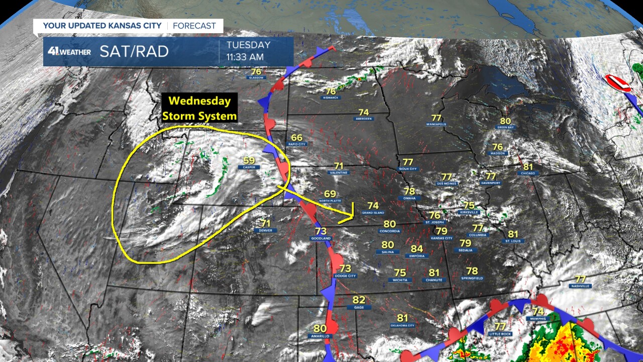
The storm system responsible for the Wednesday thunderstorms was located in Wyoming as of 11 a.m. Tuesday. It is rather well defined which is not common when tracking storm systems one to two days in advance that will affect us in early to mid-August.
TONIGHT:
The storm system will cross into Nebraska, interact with August heat and humidity and generate quite a line of thunderstorms. By midnight the thunderstorms will be mostly in Nebraska and far northwest to north central Kansas producing severe weather, mostly damaging winds, initially tornadoes are possible.
We will see a calm evening and night as temperatures drop to around 70°.
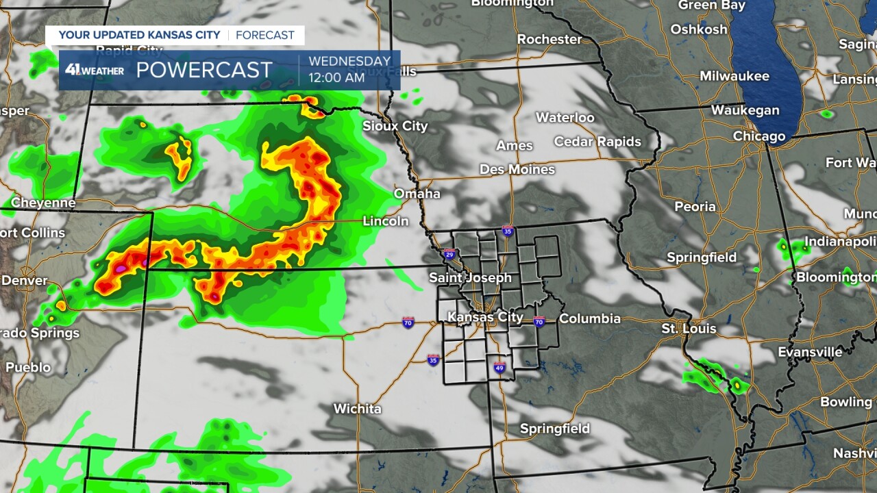
WEDNESDAY (4 A.M.-NOON):
The thunderstorms will form into a huge complex known as an MCS (Mesoscale Convective Complex). It will arrive in our area around 4-5 a.m. As it moves into our region, it will lose some of its punch as it will be morning and it will not have the heat of the day to work with.
That being said we expect periods of very heavy rain that could cause some flash flooding ("Turn Around Don't Drown," 6" of flowing water can float an SUV) along with frequent lightning. The main severe threat with this line will be 60 mph winds, but winds that high will likely be more scattered than what we saw in the July wind events. Widespread 30-50 mph wind gusts are possible. A severe wind is classified as 58 mph or higher.
These thunderstorms will likely have a big impact on the Wednesday morning rush hour.

By noon the main thunderstorms will be shifting into eastern Missouri. We may see lingering scattered showers and thunderstorms with temperatures in the low 70s.

WEDNESDAY (4-10 p.m.):
This is when we will be on the lookout for new thunderstorms to form. They will likely become severe (damaging wind, hail and even a tornado is possible), but they will most likely form along and south of I-44. The morning complex of rain and thunderstorms will likely push the hot and humid, unstable air, to southern Missouri. We will see highs around 80° with the chance for a few non-severe showers and thunderstorms.
If the morning rain and thunderstorms are much weaker and smaller in scale than what is shown above, then this could bring the afternoon and evening severe threat closer to I-70.
The data shown here has a supercell forming around Springfield, Missouri, 5-6 p.m.

BY 10 PM you can see the thunderstorms around the Missouri-Arkansas border. Also, notice the big individual thunderstorms being forecast. These are supercells and potential tornado producers. Also, notice the difference between the thunderstorms at 10 p.m. Wednesday, south of I-44, and the thunderstorms that come through our area at 7 a.m. Wednesday. The morning activity is more a big area of rain with embedded smaller thunderstorms, less severe.

SEVERE WEATHER RISK:
The Storm Prediction Center (SPC) is pretty much in line with our thinking. We are on the northwest edge of levels 1 and 2 of 5 severe weather risks. The brown area is the specific tornado threat that I overlaid the overall severe risks.
This brown area means a 5% chance of seeing a tornado within 25 mile of any one location. That sounds low, but keep in mind, on most days the chance is zero.

RAINFALL FORECAST:
It looks like most locations will see at least .50" to 1" of rain. There may be some locations that see brief training (repeat) thunderstorms. Those locations may see 2"-4" of rain. And as always, there are going to be a few locations that receive under .50".

The next chance of thunderstorms looks to be Friday and/or Saturday and/or Sunday. These chances, at the moment, look more scattered with some severe threat.
Have a great rest of your week and stay healthy.
